Mapping land cover and soil carbon for an entire country in less than a year is no mean feat.
Try Kenya - 582,646 sq km – from the arid north-east plain to the fertile region along the Tana River, and the Great Rift Valley which runs across a plateau including some of Kenya’s highest mountains.
A unique collaboration means Kenya is now on track to be an African leader in tracking carbon emissions.
CSIRO, with the assistance of the Clinton Foundation and the Australian Government, has shared with Kenya its expertise and tools for monitoring change in land cover and soil carbon.
“The work builds, for the first time, a consistent national picture of the changes," says CSIRO research scientist Peter Caccetta.
The collaboration is part of a Kenyan Government initiative called the System for Land-based Emission Estimation in Kenya (SLEEK). For the past few years Kenya has been building the SLEEK system to track emissions and removals in the land sector. This measurement, reporting and verification system will use country specific data and is based on methodology used to build the Australian greenhouse gas emissions accounting system.
When SLEEK is complete it will be capable of generating emissions data required for international reporting obligations under the United National Framework Convention on Climate Change (UNFCCC). The improved land cover information will assist with sustainable land management, including land-use planning, deforestation tracking and landscape restoration.
With the support of CSIRO, in less than twelve months Kenya has achieved great advances in mapping land cover. Using Landsat satellite imagery and CSIRO technology, the Kenyans can now map land cover and compare change over time. Data was sourced from NASA and the United States Geological Survey.
“For the first time they can see almost two decades of land change,” says Dr Caccetta.
Building capacity

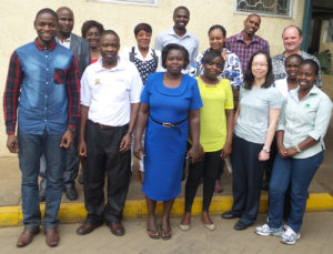
It was done through a unique collaboration between fifteen Kenyan government departments and CSIRO researchers - the first time they had worked together.
“The project was amazing because the team came from different government agencies and we needed to learn to work with each other to learn the new methods,” says Joanne Chia, CSIRO statistician
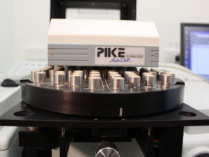
Australian Government funding provided the Kenyans with a laboratory, model software, and specialised CSIRO tools. CSIRO researchers travelled to Nairobi to train the Kenyan team in the methodology and use of the tools.
Sampling carbon in Kenyan soils
A second part of the project was to assess the amount of carbon entering or leaving the soil. A significant amount of carbon is retained in soils due to decomposing organic matter.
The challenge with mapping the organic carbon content of soils over an entire country is different soils contain varying amounts of soil carbon which can be added to or lost at different rates.
“The first step to creating a national inventory is to obtain baseline data on how much organic carbon is contained in the Kenyan soils and in what form that carbon exists,” says CSIRO researcher Jeff Baldock.

CSIRO invited Kenyan researcher Elizabeth Okwuosa to come to Australia with 800 soil samples. Working with the Australians, she measured the amount and form of organic carbon in the soil samples. This data was used to develop a Kenyan soil carbon model.
“We weren’t just trying to do some analysis,” says Dr Baldock. “We went the next step to train Elizabeth so that she could take those skills back to Kenya. This was a really positive outcome of what we have done.”
“Hopefully we have helped them to develop their own capability so they can carry on and do their work supported by us if and when required.”
Now that Kenya has mastered collecting and tracking carbon data, it is in a position to share what it has learnt with other Sub Saharan African countries which may help to improve land management in Africa.
This is a great step forward, as in the absence of accurate measurements, many countries use very imprecise estimates of their carbon budget.
