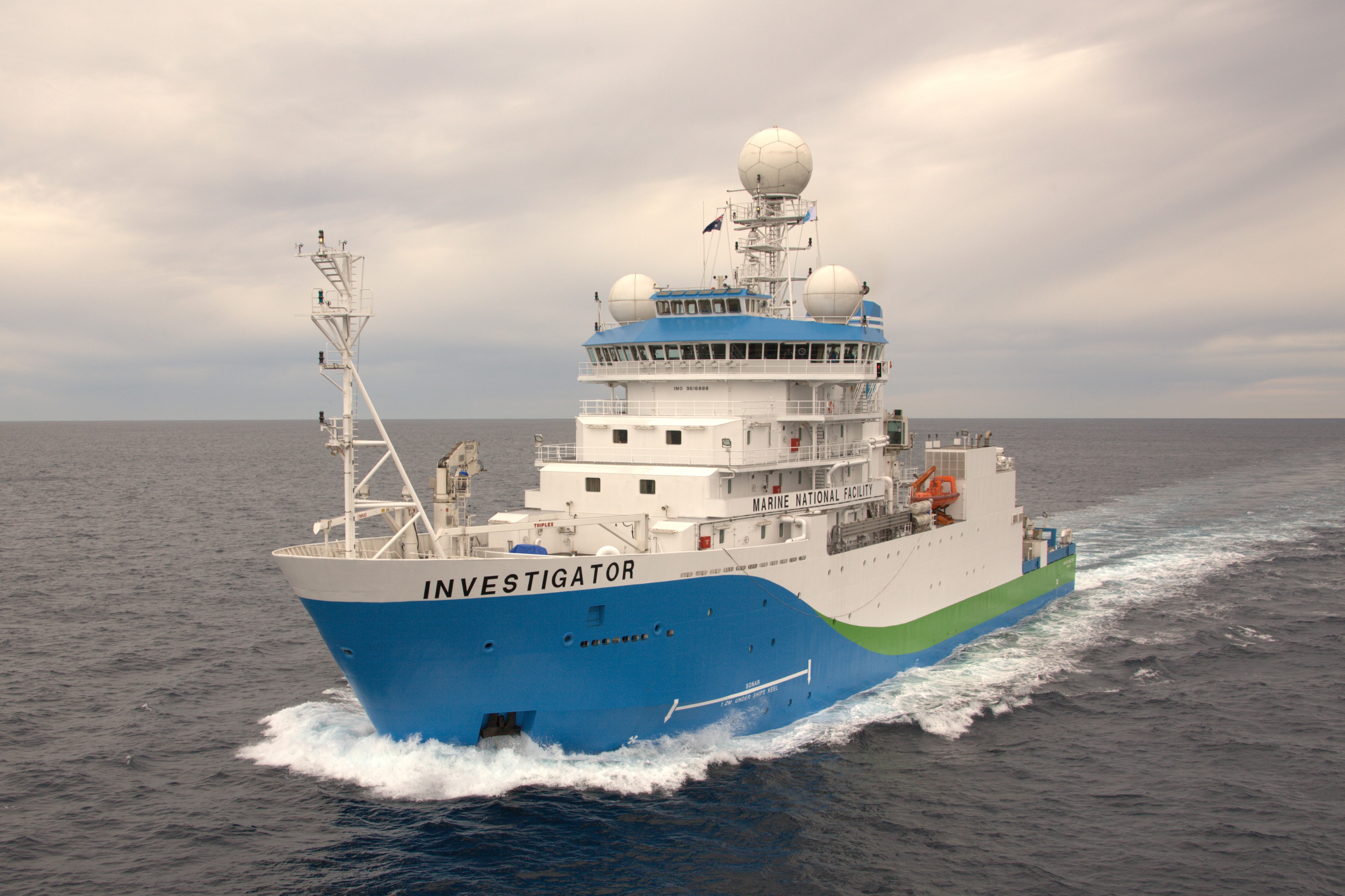
CSIRO’s research vessel (RV) Investigator is heading into the heart of the Antarctic Circumpolar Current to investigate why the planet’s strongest current that helps keep the Antarctic frozen is leaking warm water into the polar seas.
The science team led by Australia’s national science agency, CSIRO, and the Australian Antarctic Program Partnership is seeking to understand how currents in the Southern Ocean contribute to melting Antarctic ice shelves.
Voyage chief scientist CSIRO’s Dr Benoit Legresy said the Antarctic Circumpolar Current plays an important role in understanding the impact ice melt has on sea rise.
“The Antarctic Circumpolar Current flows around the icy continent from west to east and acts as our safety belt so that the warm water doesn’t reach the Antarctic and melt the ice,” Dr Legresy said.
“But the Antarctic Circumpolar Current generates the whirling eddies and finer scale dynamics that we’re trying to understand, and which are the prime suspect for warm water seeping towards the pole.
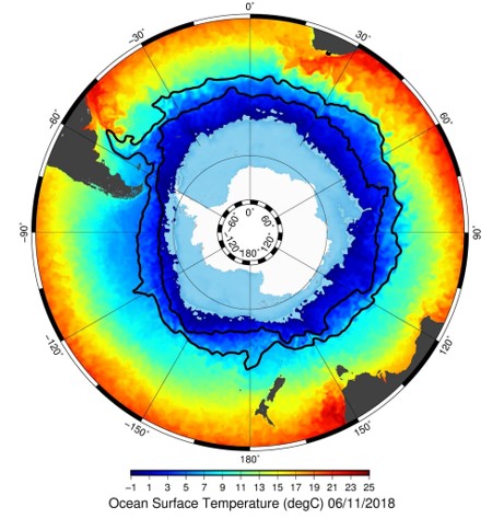
“There are five ‘eddy heat flux gates’, or hot spots, identified around the Antarctic Circle and they’re acting as a gateway for the heat to go south. We’re going to track down those small features that we think explain the heat seeping into polar waters.”
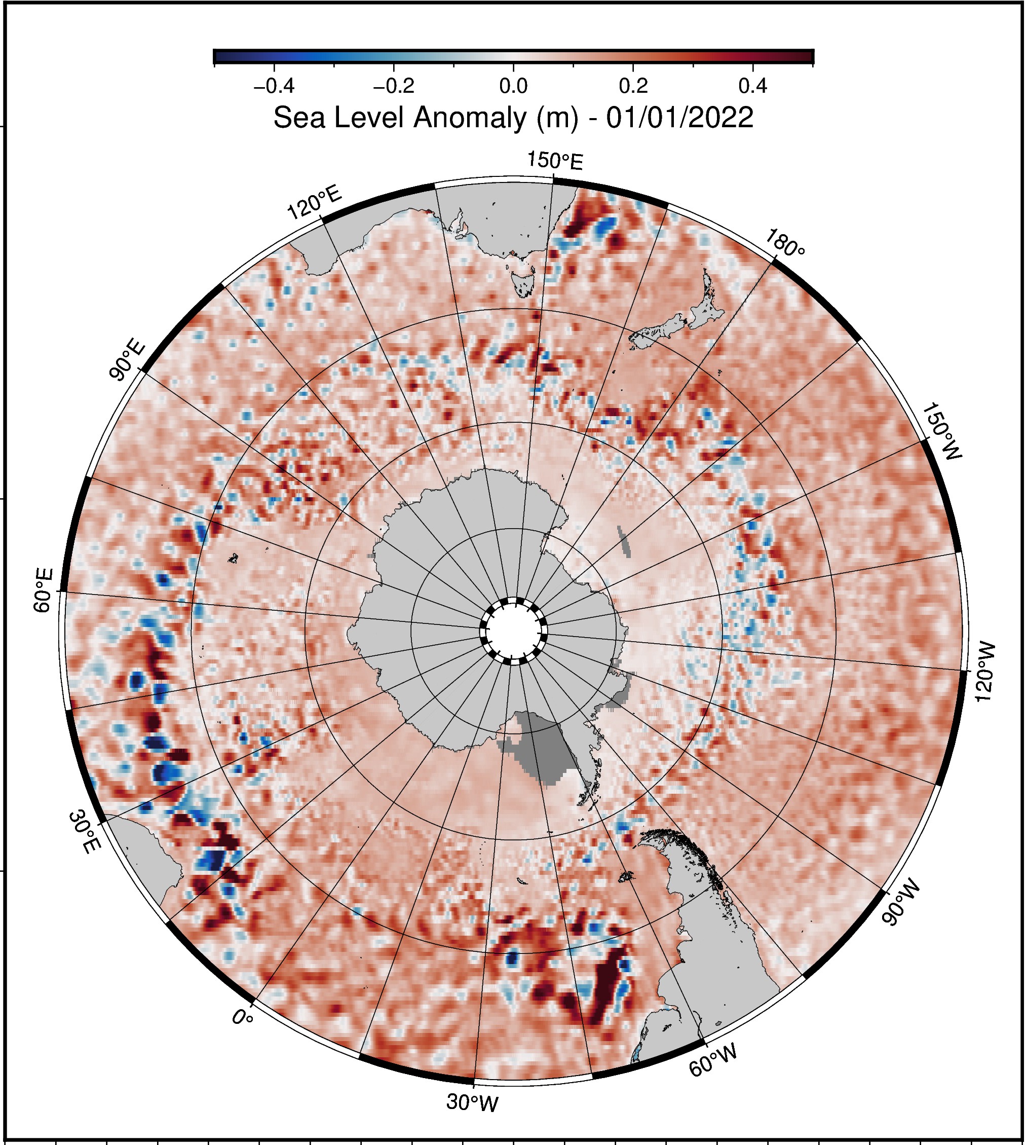
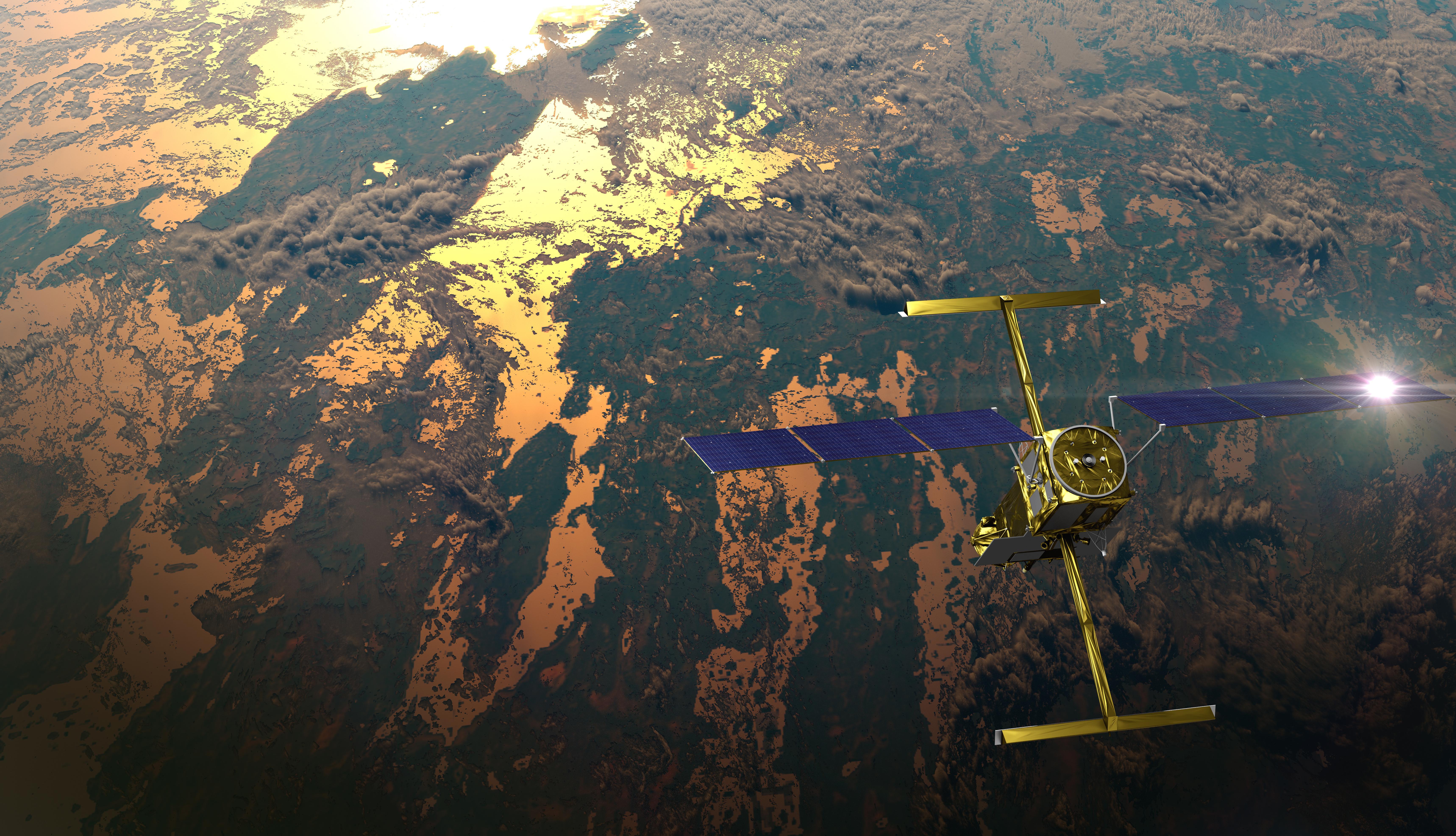
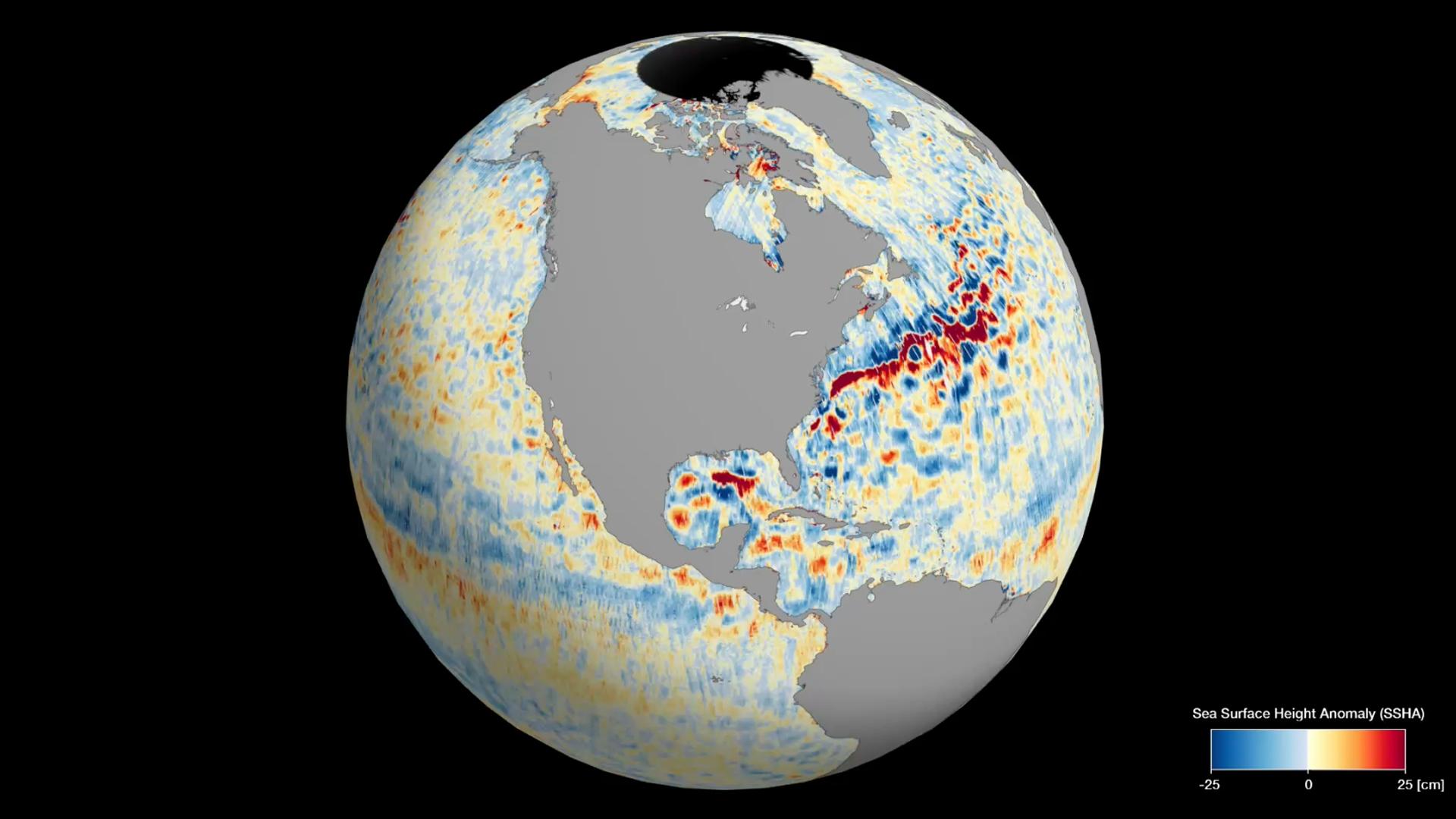
The voyage will be the first time scientists validate data of the Southern Ocean taken by the new Surface Water and Ocean Topography (SWOT) satellite, jointly developed by NASA and the French space agency Centre National d’Études Spatiales (CNES).
While the ship measures the properties of the ocean inside the current, the satellite will measure the height of the ocean surface from space. The SWOT satellite is revolutionising how scientists observe Earth’s water elevation with 2km pixel, high-definition topography.
Passing over the Southern Ocean, it will take the highest resolution ocean topography to date of the Southern Ocean and the Antarctic Circumpolar Current.
These small-scale ocean features contribute to redistributing heat and carbon and energy in the ocean, major components in global climate change.
Dr Rosemary Morrow, CNES SWOT Ocean Lead, said SWOT was a “breakthrough satellite mission”.
“Our first images already show the incredible two-dimensional structure of ocean eddies and fronts, and how they are stretched and strained by the turbulent ocean,” Dr Morrow said.
“These small-scale ocean dynamics are key in stirring heat and carbon across the ocean, but also in pumping them deep into the ocean interior.
“The new SWOT observations, combined with measurements taken on RV Investigator, will usher in a new era, by extending our knowledge from one-dimensional sections to the full 3-D ocean variations.”
The voyage continues a tradition of highly collaborative, international science concentrated on the Antarctic and the preservation of the icy continent.
Principal investigators relying on data collected from the voyage as part of their ongoing research include scientists from CSIRO, the University of Tasmania, Caltech (the California Institute of Technology), Woods Hole Oceanographic Institution, the University of Washington and the Laboratoire d'Etudes en Géophysique et Océanographie Spatiales.
The voyage departs Hobart this week and returns 20 December.
This research is supported by a grant of sea time on RV Investigator from the CSIRO Marine National Facility which is supported by the Australian Government’s National Collaborative Research Infrastructure Strategy (NCRIS).
Note to editors
Observation equipment being deployed by scientists on RV Investigator include:
Gliders
Three autonomous deep-sea ocean gliders will be deployed. They travel up and down the water column to a depth of 1000m and can navigate against and across the current. This enables them to detail the structure of the current. The gliders surface to transmit data and receive piloting instructions. They will be deployed for six months, sampling the ocean continuously over an area 180 kilometres north to south and an even greater distance west to east. One glider belongs to CSIRO and two to the California Institute of Technology. Once deployed, a team of pilots in Hobart (CSIRO), Pasadena (California Institute of Technology) and New York (Brown University) will manage the gliders for six months.
Tall mooring
The 3.6km high tall mooring will be anchored by three 1-tonne anchors in the centre of the research area for 18 months. The ship with conduct experiments with other monitoring equipment around the tall mooring which is equipped with floats and 35 instruments. While the mooring is fixed, the instruments will measure the currents, temperature, salinity and oxygen continuously and capture data every 10 minutes for the 18 months.
Triaxus
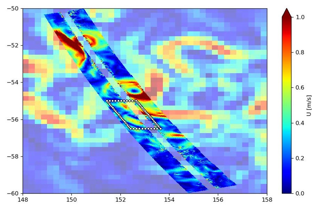
The Triaxus is towed behind RV Investigator and has wings that allow an operator on board the ship to pilot it through the water, profiling the water to a depth of 300m. New instrumentation from Woods Hole Oceanographic Institution will provide data on the microstructure of the water, measuring velocity, temperature, salinity and turbulence. The Triaxus will be guided to coincide with the satellite as it passes overhead, to validate and complement the ocean data with satellite data.
Drifters
Fifteen drifters will be deployed and will float freely with the ocean surface providing information on current trajectories and ocean dynamics, calibrated against satellite data.
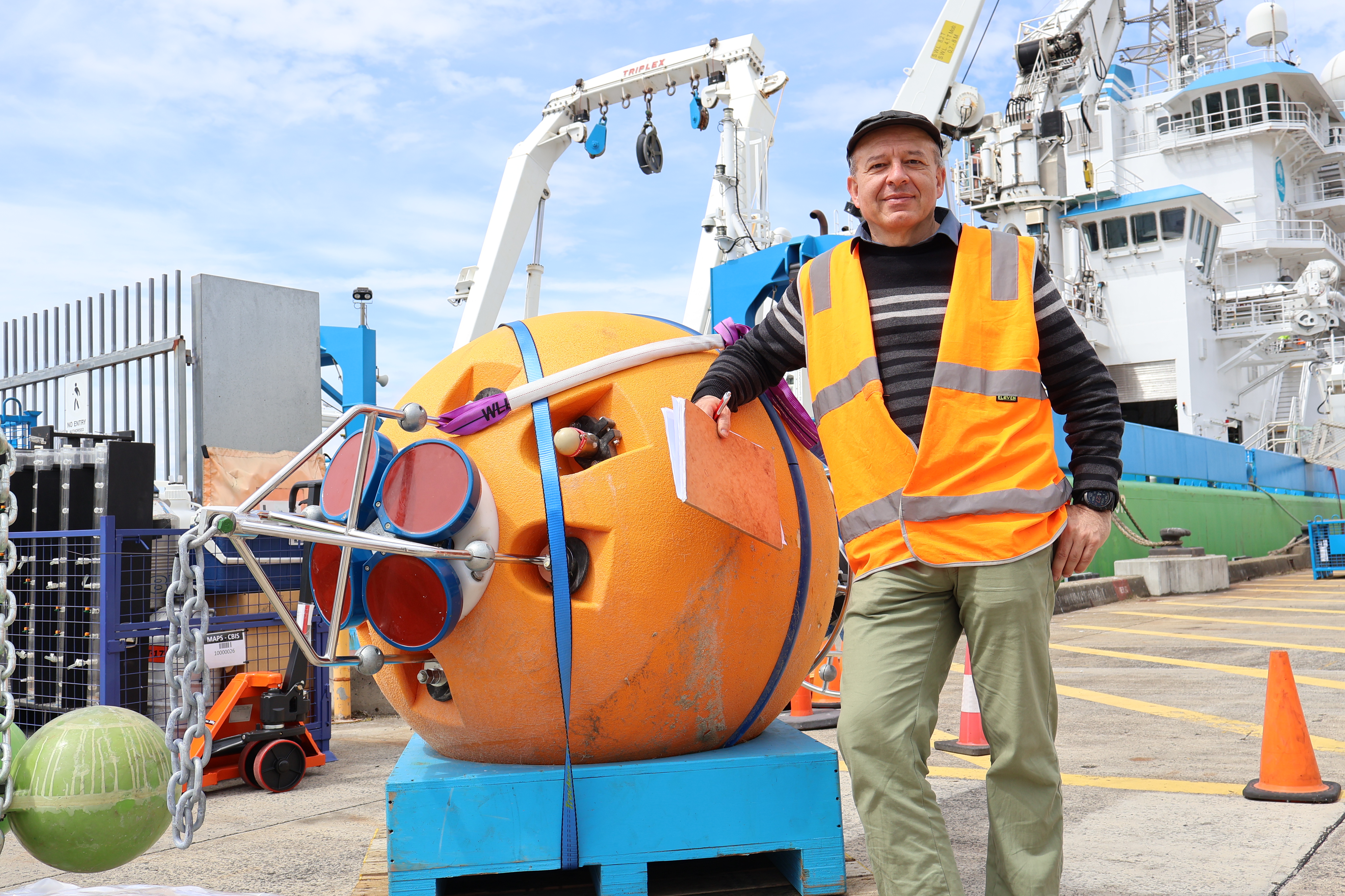
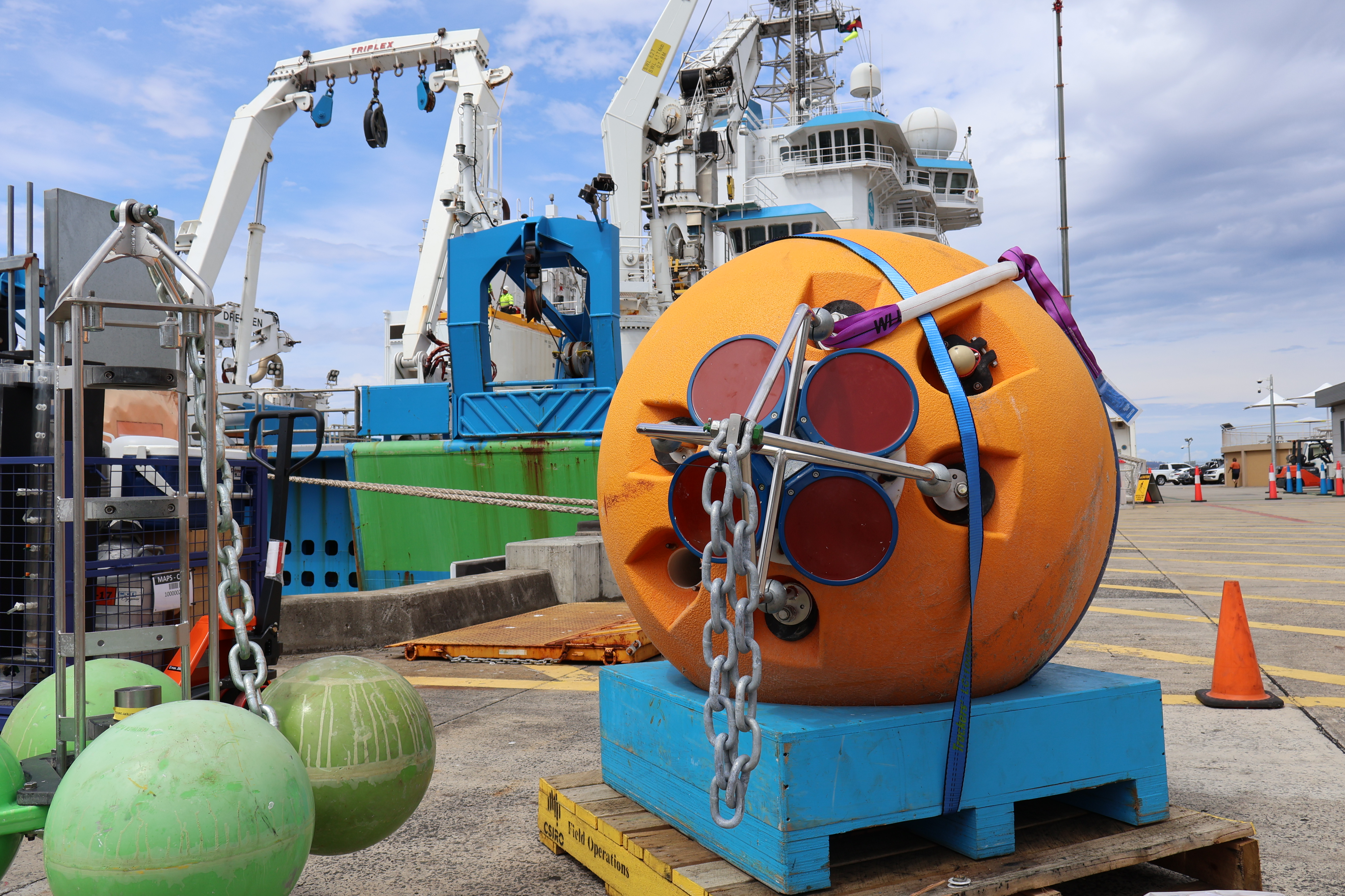
Argo floats
Six Argo floats will be deployed. All six will measure temperature, salinity, dissolved oxygen and other biochemistry as they drift with currents. Three will also measure turbulence, or microstructure, of the current.
CTD Rosette
The conductivity, temperature and depth (CTD) rosette can reach the bottom of the ocean and will be deployed 130 times during the voyage. As well as measuring the current, it measures temperature, salinity, oxygen, nutrients, fluorescence, dissolved carbon and takes water samples for further analysis. Scientists will analyse for carbon absorption by the ocean and the diversity of phytoplankton.
Images
B-roll video
