Australia’s national science agency, CSIRO, together with its Australian National Soil Information System (ANSIS) partners, has launched a new online tool that makes soil data and information easier to access and interpret – helping farmers, land managers and policy makers better manage soil health and sustainability.
ANSIS was launched in 2023 and brings together soil data from across Australia, connecting multiple data sources to provide access to nationally consistent soil data and information.
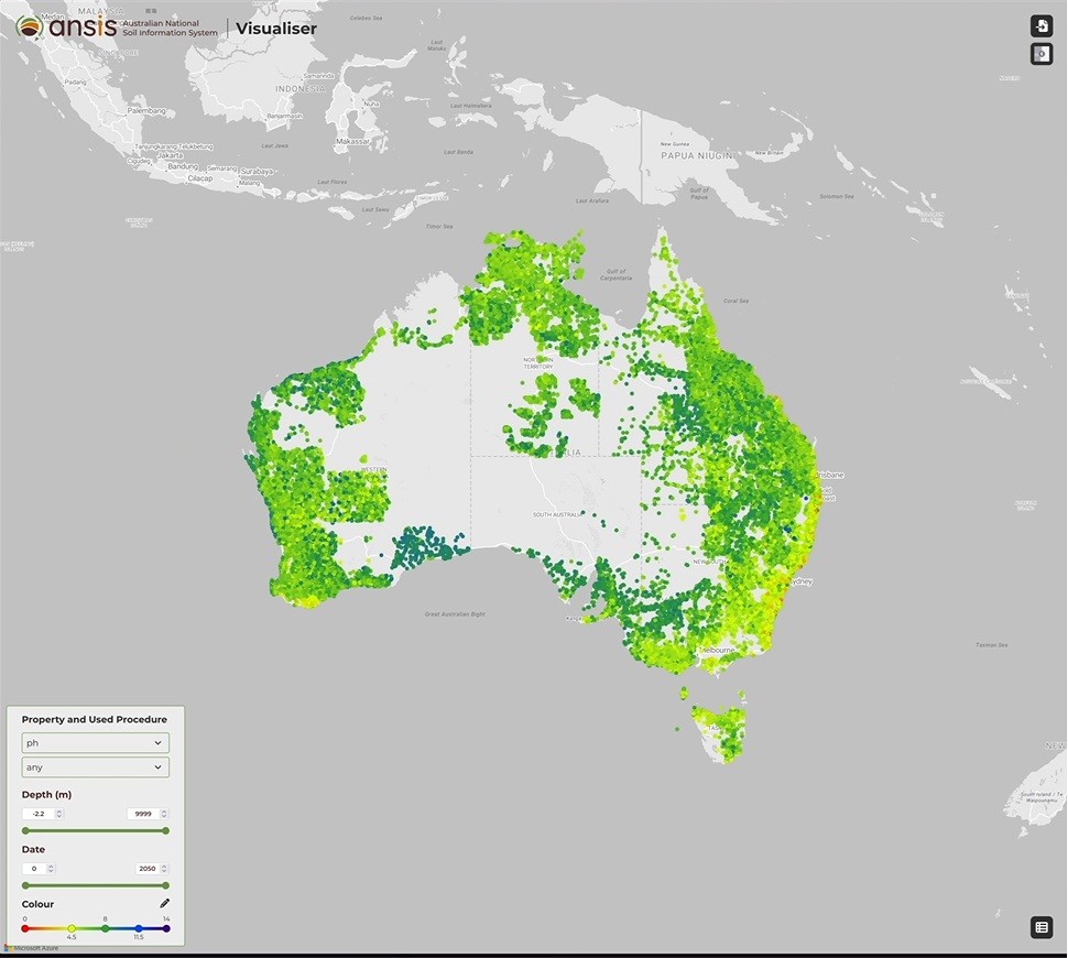
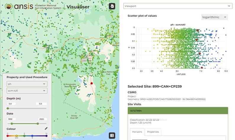
The new ANSIS Visualiser tool uses colour to show differences in soil properties such as pH or soil organic carbon across Australia.
CSIRO soil scientist and ANSIS project leader Peter Wilson said the Visualiser tool turn complex soil data into clear, visual insights leading to improved understanding and management of soils and soil health.
“This new tool will provide policy makers, researchers and land managers with a clear view of the soil data and information they need to better manage, restore, and protect Australia’s soils,” Mr Wilson said.
“Soil data are often complex and hard to interpret, so this new tool can help people better understand their soil and make better management decisions.
“With this new tool you can instantly see how a soil measurement at one site compares with other sites around it.
“It also provides graphs so users can easily interpret changes in soil property with depth.”
ANSIS supports the Australian Government National Soil Action Plan 2023-2028, which has four priority actions that relate to soil measurement, strategy integration, adoption of best practices, and capacity building.
“Soil is the backbone of Australia’s agriculture, biodiversity and many priority ecosystem services,” said Mr Wilson.
“By measuring soils and proving access to data via ANSIS, we can better understand what impacts we are having on soil, their health and their ability to function to provide the services we need.
“Caring for soil today ensures food and environmental security for future generations.”
Visit ANSIS and use the Visualiser tool.
ANSIS is supported by funding through the Australian Government Natural Heritage Trust (Department of Agriculture, Fisheries and Forestry) in collaboration with CSIRO.