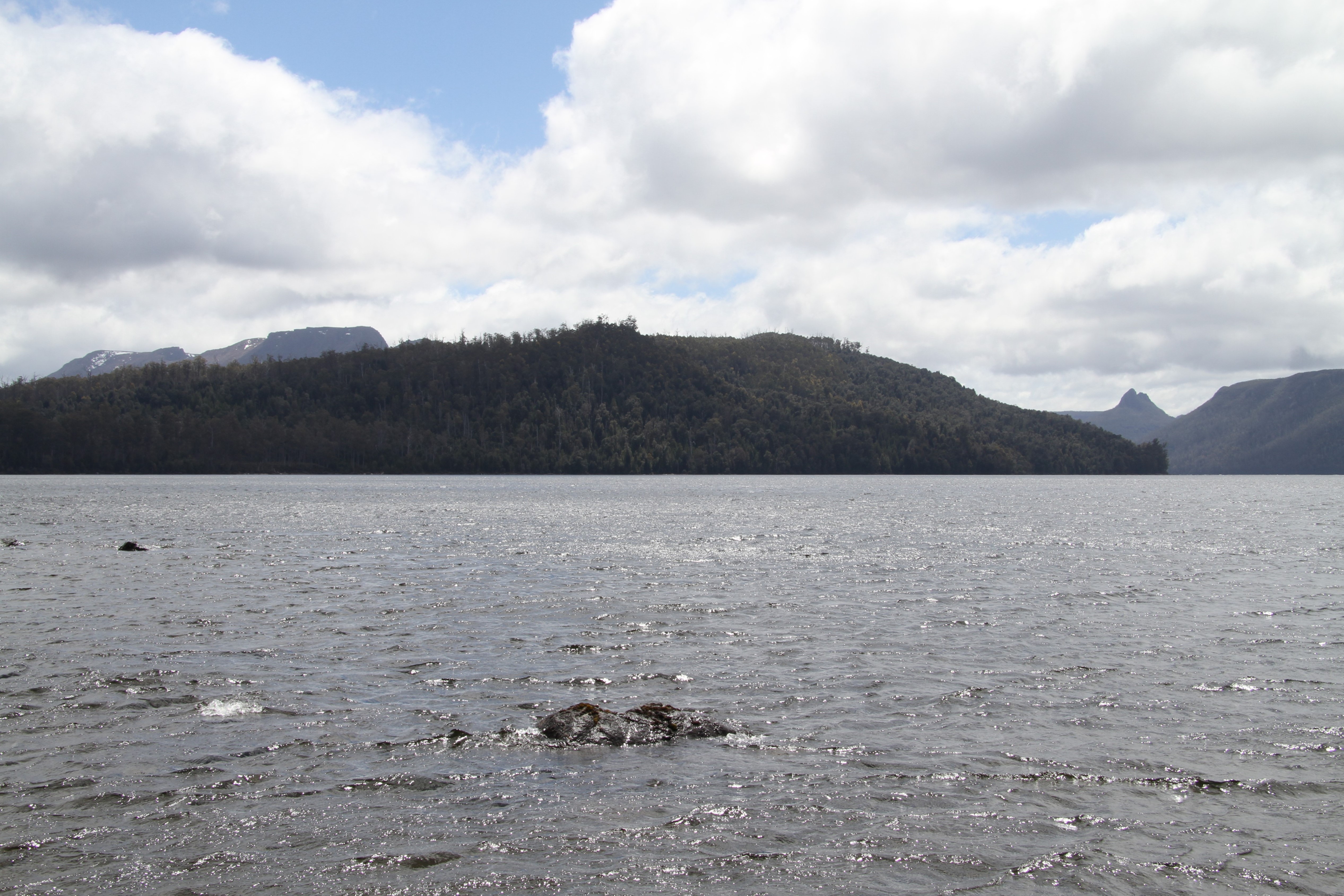
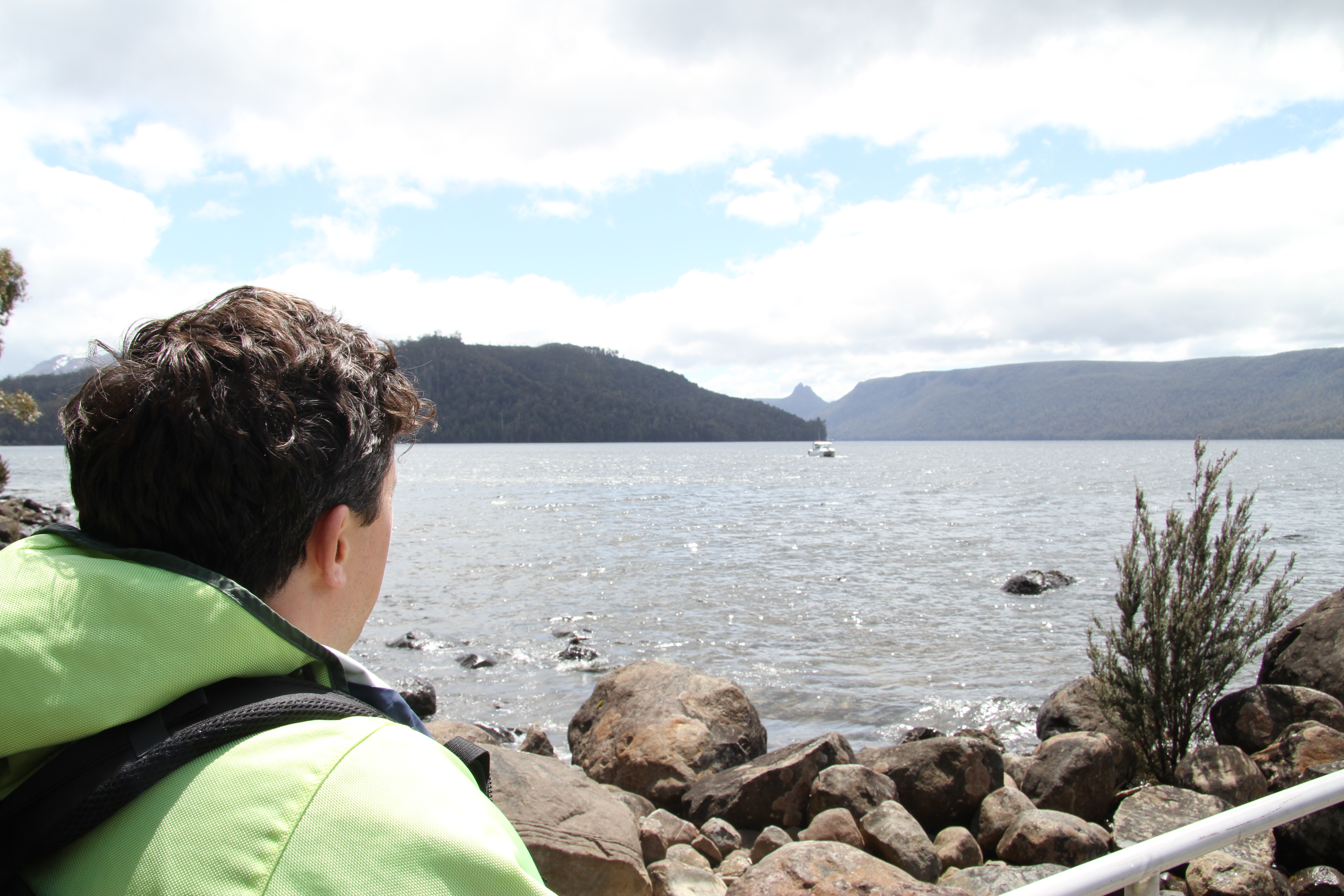
A high-tech mapping team from CSIRO, Australia's national science agency, has produced an incredible new view of one of Tasmania's most iconic natural features and Australia's deepest lake, Lake St Clair in Tasmania's central highlands.
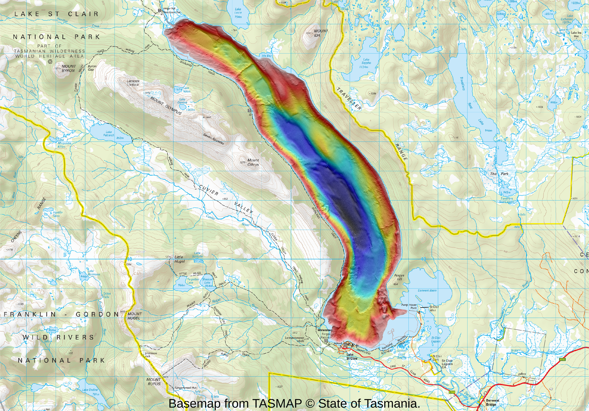
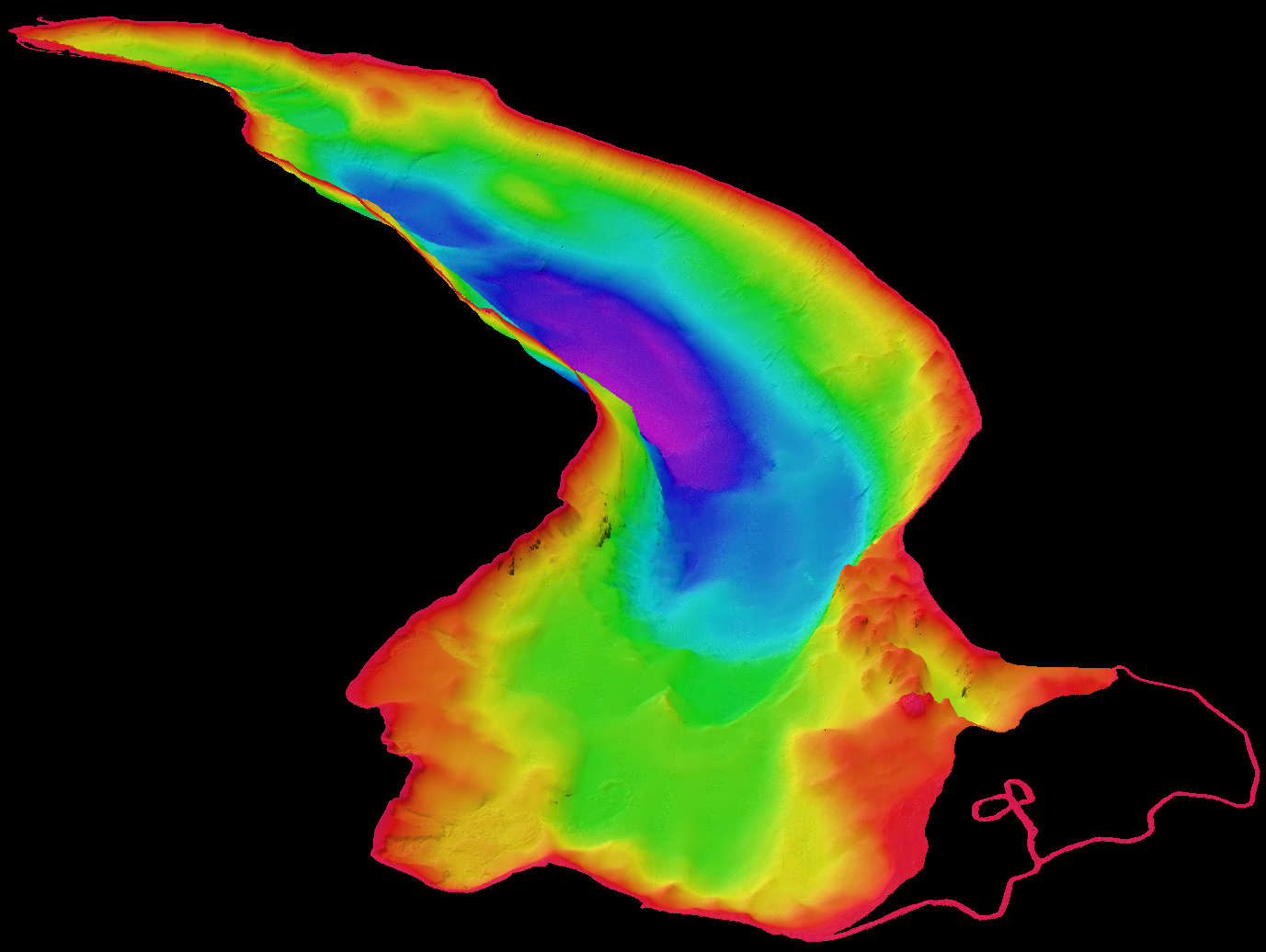
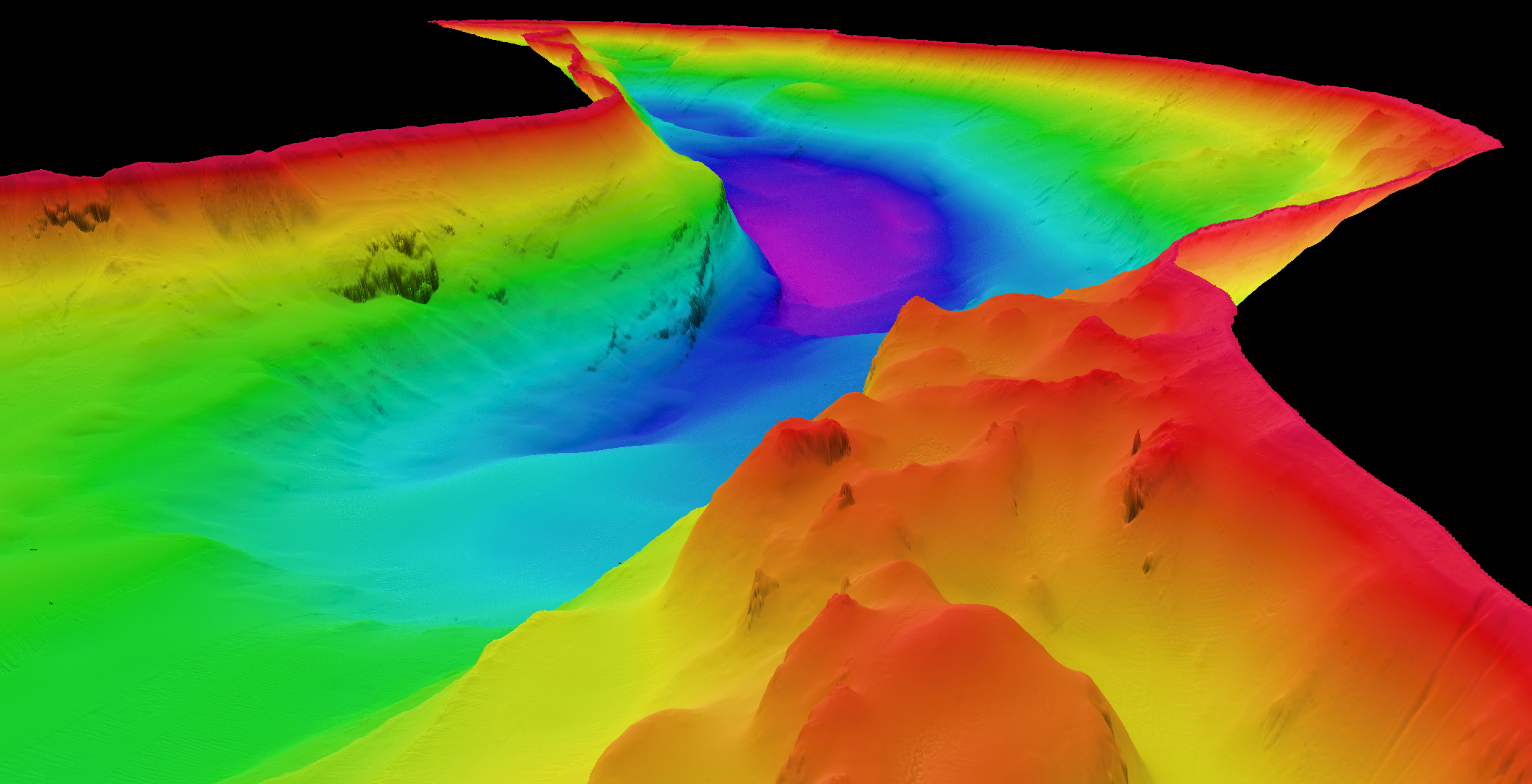
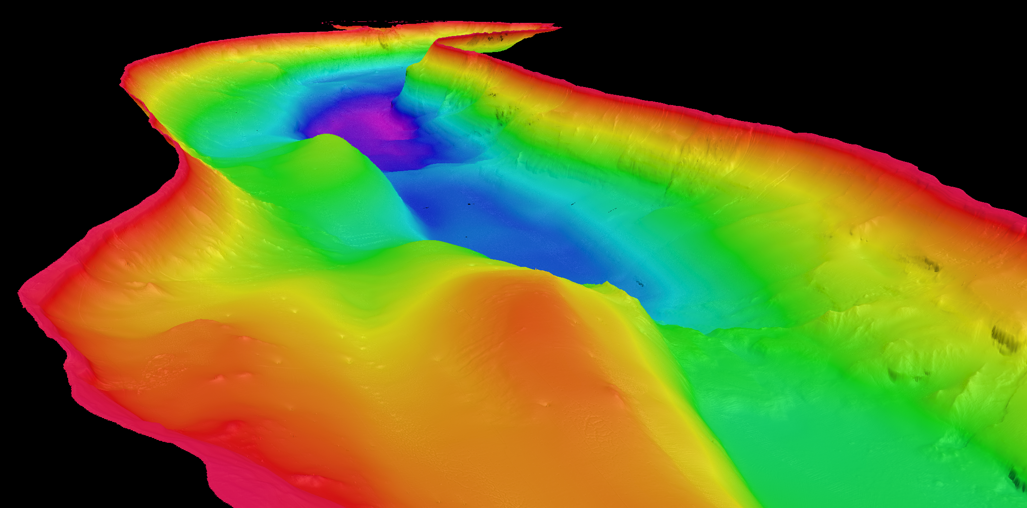
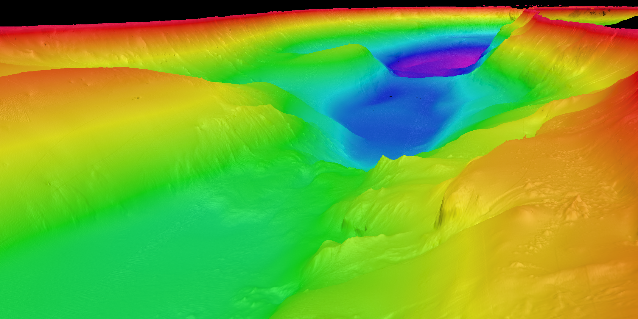
Using advanced multibeam sonar and Light Detection and Ranging (LIDAR) technologies, the team has produced the first high-resolution 3D map of the lakebed and shoreline, uncovering dramatic underwater cliffs, deep ravines and towering rock formations.
Lake St Clair was carved from the surrounding bedrock by ancient glaciers and is internationally known for its wild beauty as part of the UNESCO World Heritage Cradle Mountain-Lake St Clair National Park. However, the maximum depth of the lake has never definitively been confirmed, though past reports estimate it between 160-215 metres.
CSIRO's mapping has now officially confirmed its maximum depth, with the lake plunging to 163 metres. This is far deeper than any other lake in Australia and deeper even than Bass Strait, which has a maximum depth of approximately 85 metres.
CSIRO hydrographic surveyor, Augustin Déplante, said the mapping offers a stunning new view of the lake and solves the mystery of its true depth.
"Our mapping confirms that Lake St Clair is absolutely Australia's deepest lake, with the next deepest lake being less than 100 meters deep," Mr Déplante said.
"We found Lake St Clair's deepest point is close to the western shore on the bend in the lake about 4 kilometres north of the visitor centre, but there are several areas where the lake depth reaches 150 metres," he said.
CSIRO will share the 3D dataset with various stakeholders to support increased understanding of the lake’s underwater habitats and how it was formed. The data will also assist safe navigation on the lake and future research, including the use of the lake for testing autonomous underwater vehicles.
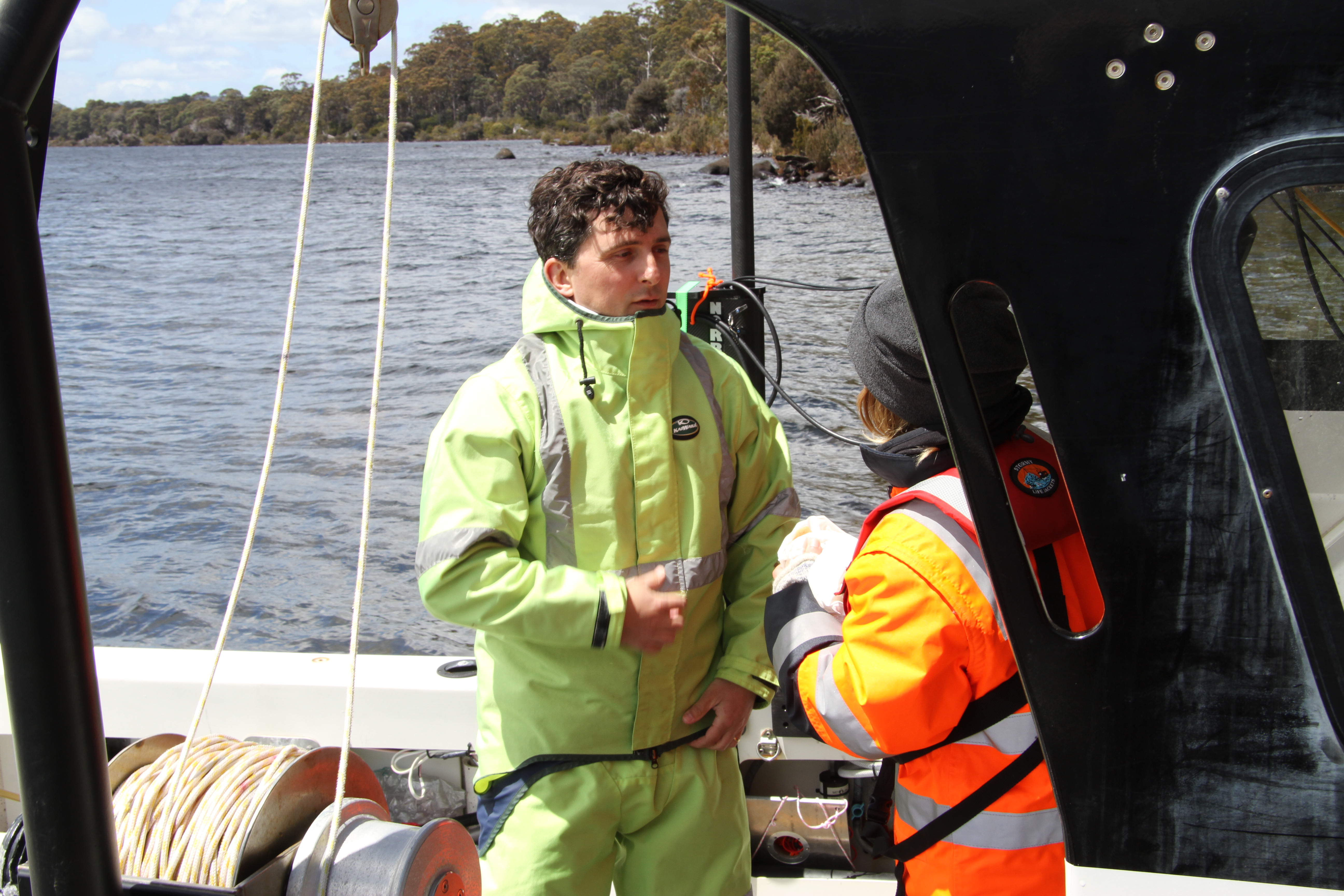
The team battled wild weather to systematically map the lake over 8 days using advanced, high-resolution multibeam echosounders, a type of sonar which use pulses of sound to measure the water depth.
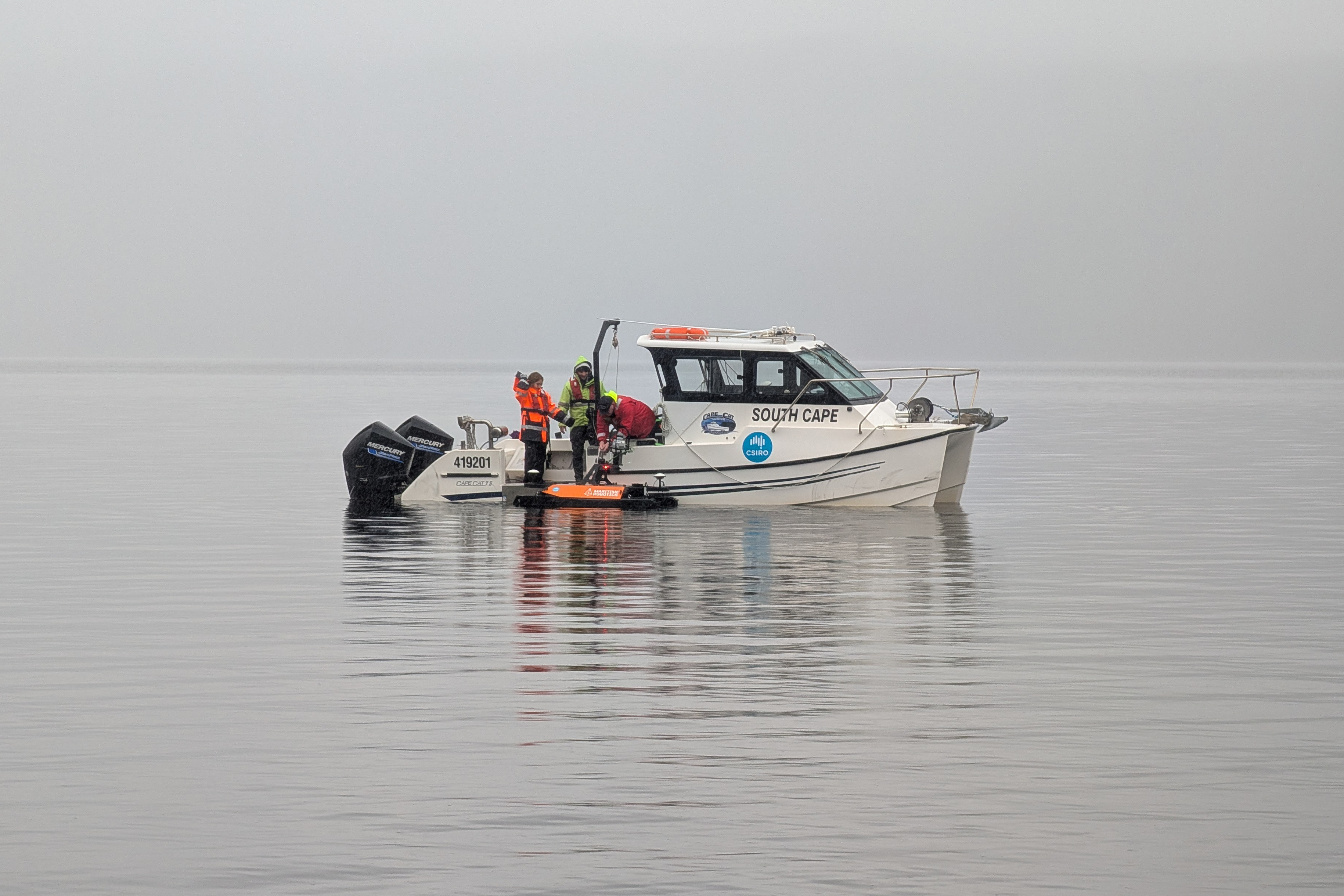
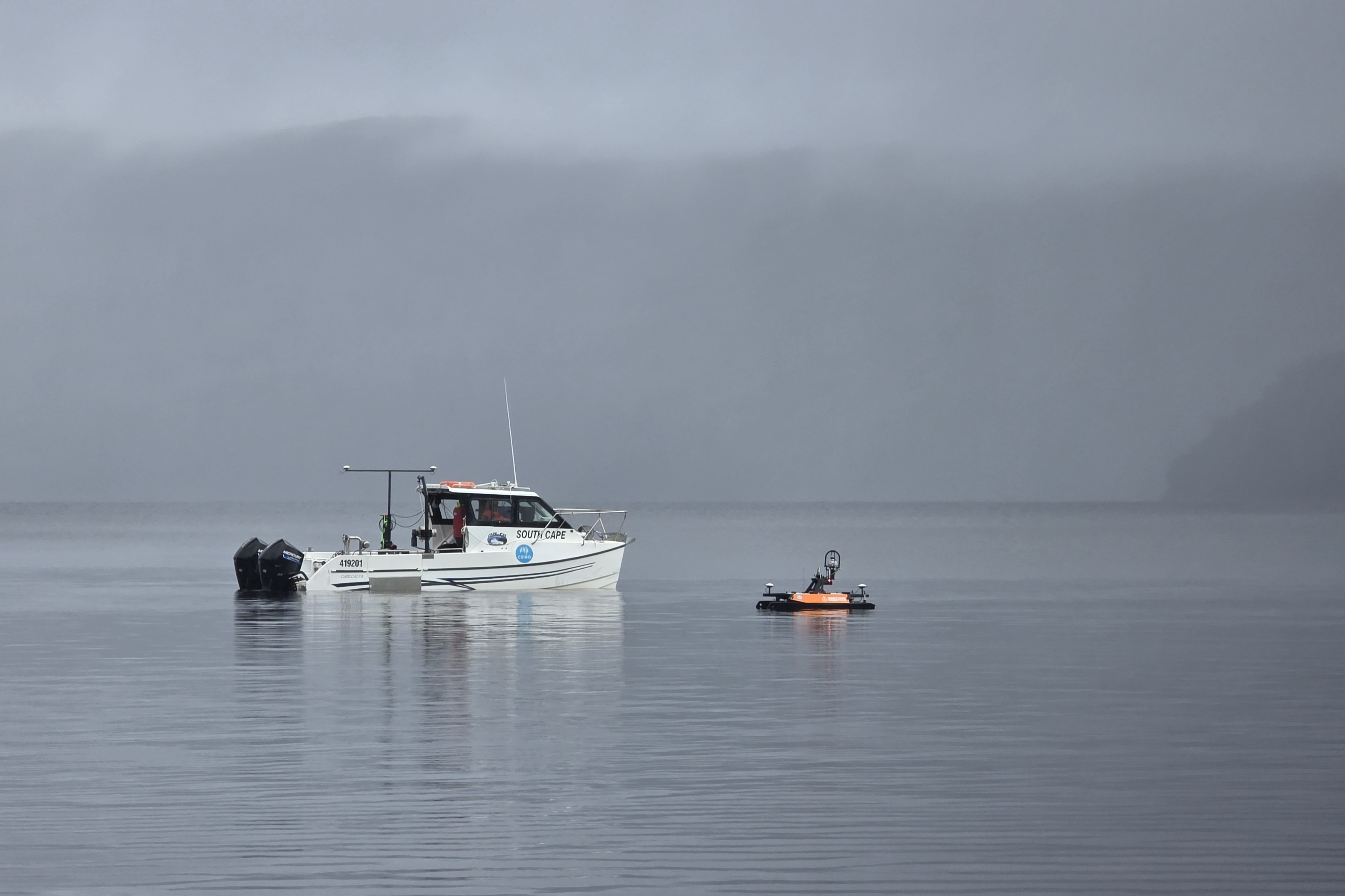
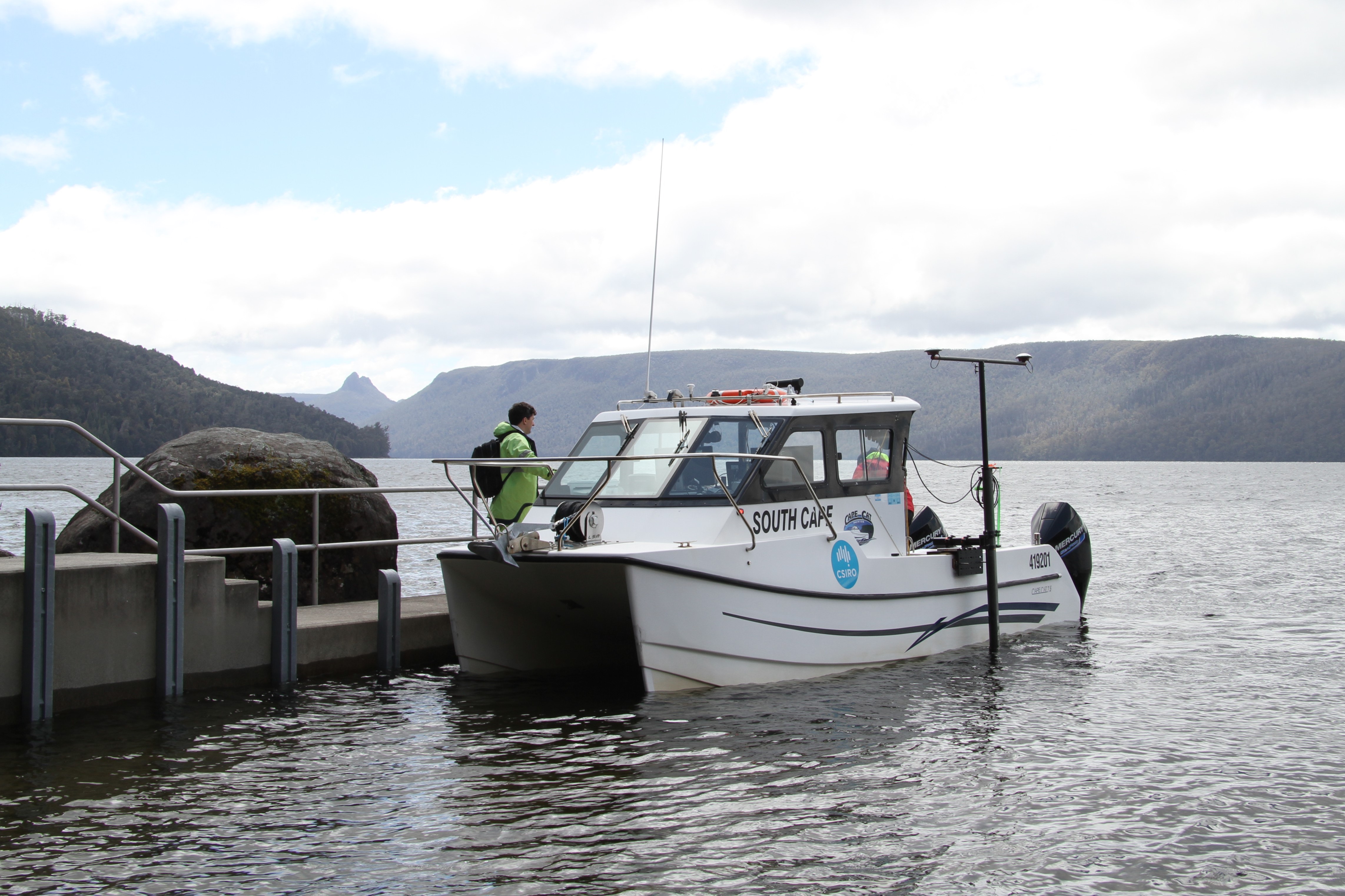
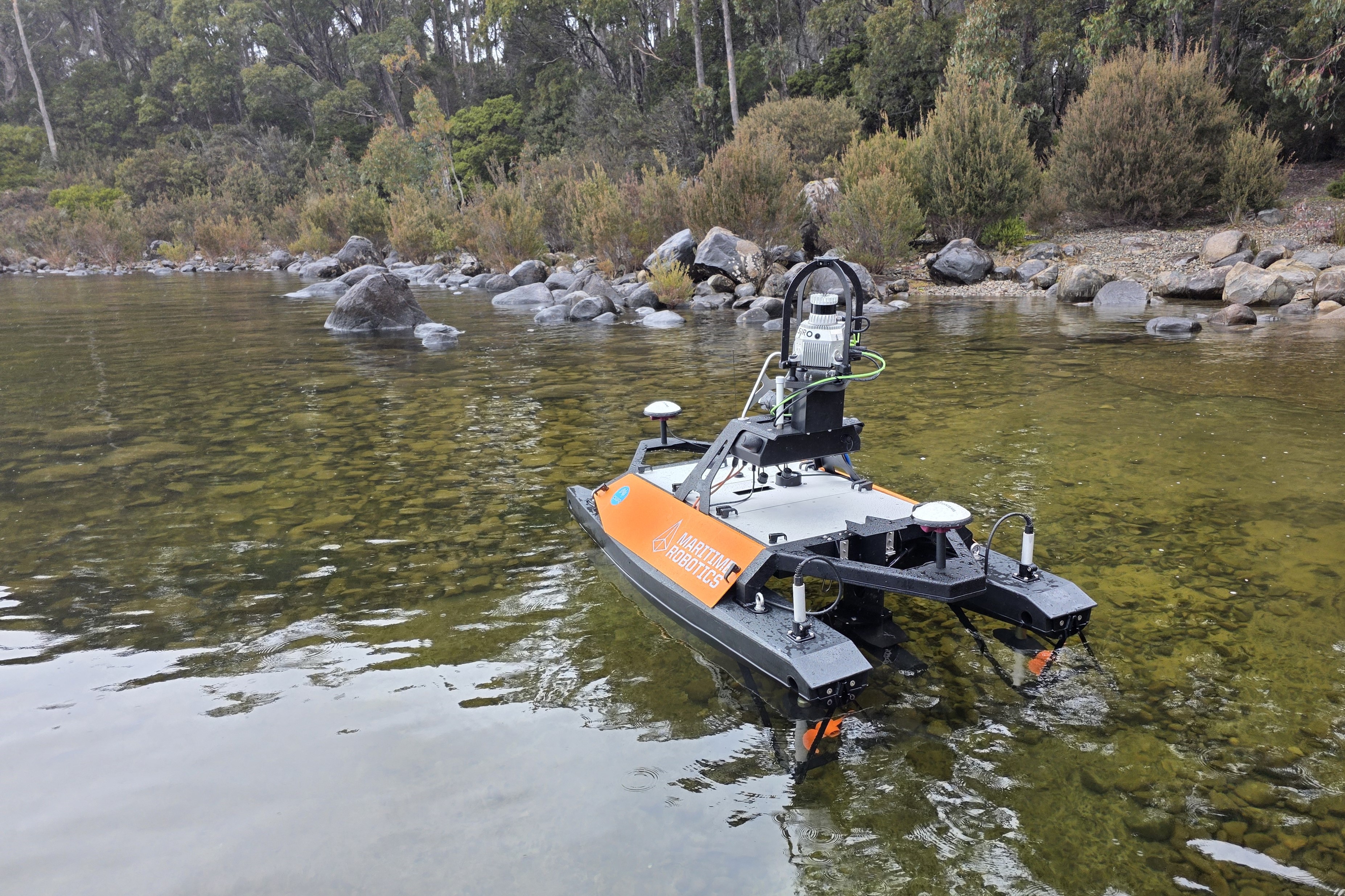
The project was completed using a twin-hulled 8-metre research vessel, RV South Cape, and a 2-metre unmanned, remotely operated vessel called the Otter. The Otter's smaller size enabled mapping in shallow areas inaccessible to larger vessels.
The Otter also used LIDAR technology to map the lake shore and this data was integrated with the underwater mapping to produce a single 3D dataset.
"The mapping is highly detailed and can identify objects as small as 50 centimetres in some places. Along the shoreline, it shows the trees that have fallen into the lake and, in deeper areas, has revealed several mysterious features on the lakebed, sparking curiosity about their origins," Mr Déplante said.
"While the data does not confirm the presence of a Lake St Clair 'Loch Ness' monster, it does offer a powerful new tool for exploring the lake's hidden depths.
"Importantly, the project provided us with the opportunity for cross-disciplinary training for our team and to integrate the latest technologies into our toolbox to enhance the capabilities we offer the research community."
The project was led by CSIRO's Engineering and Technology Program in Hobart, with support from the Autonomous Sensors Future Science Platform. These programs deliver a wide range of expertise and advanced technologies to support Australia's marine, freshwater and terrestrial research, including in remote and complex environments.
The underwater mapping was delivered using Norbit multibeam systems provided by Seismic Asia Pacific.