A powerful new tool for unlocking Australia’s mineral wealth has been revealed using incredibly detailed satellite images.
The hyperspectral map, produced by CSIRO, Australia’s national science agency, uses satellites to capture reflected light across more than 200 narrow spectral bands. Essentially, it shows the makeup of minerals on the surface of the entire continent, helping pinpoint areas which may be rich in deposits.
Previously, satellites only captured images across 14 bands.
The technology is particularly relevant as Australia seeks to strengthen supplies of critical minerals needed for clean energy technologies, advanced manufacturing and national resilience.
CSIRO Research Director, Dr Sandra Occhipinti said the new hyperspectral mapping capability is like the difference between listening to 14 notes on a piano compared to a full orchestra.
“Until now, this level of detail could only be obtained by field and laboratory measurements, which can only be done on a smaller scale. Remote sensing from satellites opens up our view to the full continent,” Dr Occhipinti said.
“The technology is so advanced, it has wider applications for agriculture and environmental monitoring.”
The achievement builds on CSIRO’s long-standing leadership in Earth observation for the resources sector, following the release of the world’s first ASTER-derived continental-scale mineral maps in 2012, which helped support greenfield mineral discoveries across Australia and delivered $363 in benefits for every dollar invested by the Australian Government.
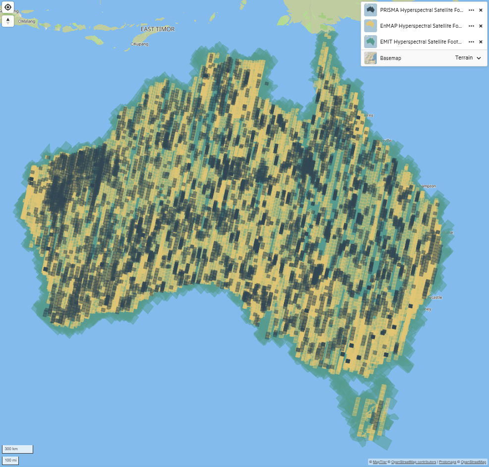
CSIRO has developed automated workflows to combine imagery from three satellite missions: Italy’s PRISMA, Germany’s EnMAP and NASA’s EMIT. The team processed hundreds of terabytes of data, addressing challenges such as cloud cover and data quality to build a continent-wide mineral dataset.
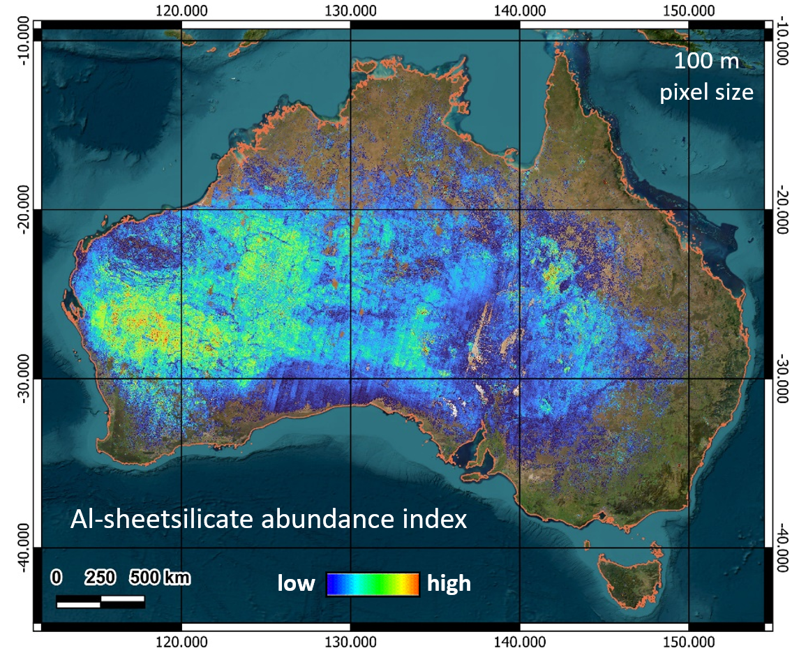
One of the first hyperspectral maps shows aluminium sheet silicate mineral abundance across Australia, revealing a new mineralogical layer that can uncover signatures from Australia’s bedrock related to mineral footprints around ore deposits.
“This can help explorers target prospective areas more effectively, reducing time, cost and risk in the search for new mineral resources,” said Dr Occhipinti.
The continental-scale hyperspectral mapping program is part of CSIRO’s ongoing Earth observation research, which focuses on developing new methods to convert satellite data into practical geoscience information for the mineral resources sector and beyond.
“By transforming advanced satellite imagery into practical geoscience products, we are helping unlock Australia’s resource potential while supporting more informed environmental and land management decisions,” added Dr Occhipinti.
The mineral map layer can be downloaded and viewed for free through CSIRO’s XT Portal.