Remote sensing of inland water quality
Existing inland water quality data for Australia is scarce but what data we have shows that Australia's inland water quality is declining.
Fast and cost-effective assessments are needed to assess baseline conditions of our inland water quality so we can identify changes in response to influences such as land use changes, flooding, fires and climate change and predict their future state.
Once developed, a monitoring approach based on a combination of near-surface and satellite methods, could improve knowledge of inland water quality conditions of interest to both the scientific community and management agencies alike.
Such conditions could include the occurrence, timing and persistence of blue-green algal blooms (cyanobacteria), black water events, and general indicators of eutrophication status.
Traditional sampling approaches require repeated travel to often remote and harsh areas; they may also involve costly follow-up laboratory analyses. But we need assessments across a range of scales, from in-situ measurements through to large regional-scale investigations.
Over a 10-year investment strategy, CSIRO has developed a way of using remote sensing techniques to remotely detect ‘visually active’ water quality variables in marine coastal waters. Inland water retrieval of water quality parameters is more complex and currently being investigated for broad scale application.
By measuring the colour of the water in detail, variables such as chlorophyll, cyanobacterial pigments, organic and inorganic sediments as well as dissolved organic matter can be quantitatively observed. The approach of measuring water colour works for instruments in close proximity to the water surface or for satellite sensors based hundreds of kilometres in space.
CSIRO has developed an algorithm based on physics-based adaptive linear matrix inversion (aLMI) which can simultaneously derive concentrations of a number of water quality variables over different water types. The Great Barrier Reef Marine Park Authority now uses this technique for systematic and cost-effective assessment of water quality variables in the Great Barrier Reef lagoon using satellite data.
The current project has also investigated the application of the aLMI to develop this same capability for Australia’s inland waters. The algorithm requires different optical datasets to cope with the greater range of water quality that exists in inland waters. One of the project objectives is to collate and evaluate existing datasets and develop new datasets for variables relevant to Australian inland waters.
As well as testing the method on satellite data, the project also tests novel, ‘near-surface sensing’ approaches to provide continuous water quality monitoring. These methods are validated against traditional sampling methods.
Projects for the use of near-surface sensors and satellite retrievals are underway in the Murray Darling Basin, Melbourne water treatment plant, Queanbeyan near ACT and across Queensland. The differing water types provide opportunities to investigate the robustness of the approach, covering a range of hydrological conditions, sediment events and blue-green algal blooms. Further plans include a data dashboard retrieval service and visualisation tools.
Shedding light on Australia's lakes and reservoirs from space
The bio-optical measurements are also part of a project that CSIRO’s Aquatic Remote Sensing Team Leader, Janet Anstee, hopes will lead to the development of a continental scale product for assessing Australia’s inland waters from space.
Janet Anstee and her team are measuring the optical properties of Australian lakes and reservoirs in order to build tools that can be used to identify trends in inland surface water quality and the response of inland water systems to extreme events (such as fire, floods and drought), land use and climate changes.
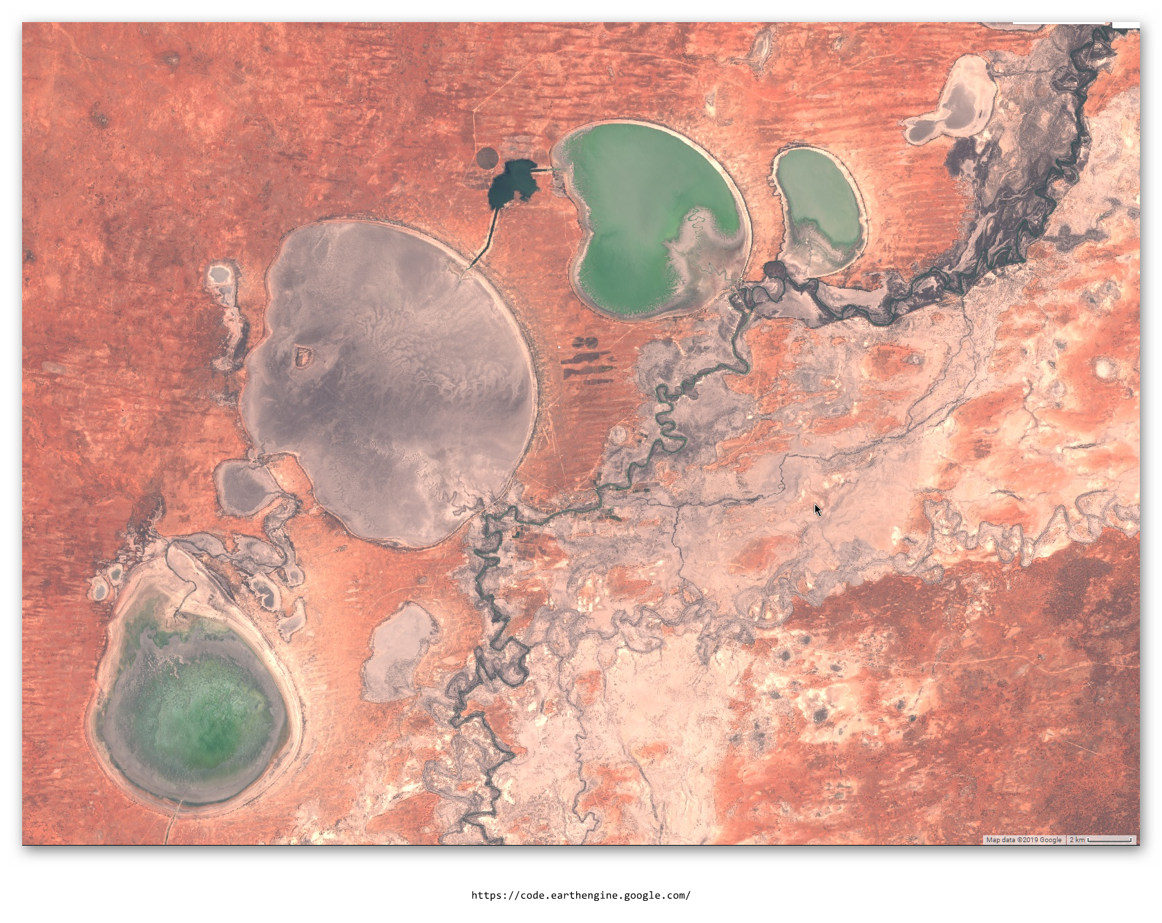
Remote sensing studies of inland water quality to date have been limited to local or regional assessments.
Janet Anstee's project in collaboration with Geoscience Australia aims to develop a nationally applicable inland water monitoring capability with an operational and technical focus. This involves measuring the optical properties of inland water systems and comparing them to remote sensing signals from space.
The project team will measure the absorption, attenuation and backscattering of light in reservoirs and lakes in NSW, Victoria (within the Murray Darling Basin) and WA. These measurements will be used to model the remote sensing signal (the colour of the water surface determined by the amount of reflected light at different wavelengths) that can be used to parameterise the remote sensing models.
"By measuring the light absorption and backscattering properties of reservoirs such as Lake Hume in the Murray Darling Basin, we can understand the complexity of conditions that give the lake its colour,” says Janet Anstee. “This understanding will help us build the tools needed to estimate suspended matter and algal concentrations from space."
In addition to the below surface water measurements, a citizen science water quality project will be integrated. Using the current Eye on Water Australia project app and database, the citizen’s water colour measurements are converted in to the Forel-Ule scale (a scale of 21 colours ranging from blue, green, yellow and brown). This provides a bridge between the measurements in the water and those received from the satellite.
The team will also be collecting water samples and analysing them for chlorophyll, suspended sediment and coloured dissolved organic matter back in the laboratory. By relating the water samples with the remote sensing signals, the team will be able estimate water quality from space at regional to continental scales.
The intention of this project is to provide a cost-efficient tool that can be used by water managers to monitor the condition of Australia’s inland water systems and reduce the requirement for repeat travel, often to remote areas, and the need for costly laboratory analyses.
The products developed from this project will also be used to operationalise remote sensing products for water quality management and to be potentially integrated with hydrodynamic modelling for prediction and forecasting.
The development of blue-green algae in our waterways strongly depends on changes in their physical environment, driven by light, temperature and flow beside nutrient limitation. Measuring those parameters allows for detailed simulation and forecast based on weather pattern, climate variations, and flow regimes.
Knowledge of the physical environment allows for follow-on description of ecosystem processes in the aquatic environment, like growth of blue-green algae, changes in dissolved oxygen, or simply water temperature which to a large extend determines rates of biological processes.
Over the last years CSIRO has developed a capability in hydrodynamic modelling of lakes, reservoirs and rivers to simulate water quality parameters over historical periods up to current state. This allows to “gap fill” the course of these parameters over time whenever local measurements are not or only sparsely available.
The Modelling Water Ecosystems team around Klaus Joehnk has developed such tools for Lake Hume, Melbourne water’s largest water treatment plant, River Murray and sub-catchments in the MDB, allowing to assess the risk of blue-green algae blooms and blackwater events in these systems and develop management strategies to achieve healthier waterways.
Using weather forecasts and flow conditions, these tools allows for a short-term prediction of e.g. blue green algal development 7 to 14 days ahead. And integrating climate studies long term, large scale predictions of the future state of Australian waterways are made possible.
To increase predictive capability, reduce uncertainties, and allow for a larger scale, regional assessment of BGA risks and other water quality parameters, it is necessary to include detailed knowledge of the current situation as provided by remote sensing, locally installed monitoring systems or water quality retrieved from satellite images.
Combining both approaches, hydrodynamic and water quality modelling with remote sensing monitoring of inland water is expected to provide real time data and forecasts of water quality in lakes and rivers across Australia in the future.
How CSIRO helped
Outbreaks of cyanobacteria blooms (harmful algal blooms – HABs) in aquatic systems pose a serious threat to public health, economy and biodiversity. They can produce toxins harmful to animals and humans and produce odour problems when decaying.
In order to minimise water supply interruptions, it is important to develop tools for early warning and short-term forecast of cyanobacteria blooms to allow for early intervention.
Remote sensing (satellite, drone, hyperspectral cameras) can offer both cost and time effective ways to monitor water quality, detect early warning signals and thus provide the basis for cyanobacteria forecasting tools.
We integrate the newest technology in remote sensing of water quality with advanced data and modelling capabilities.
Together with Melbourne Water, we have developed a HAB early warning system based on historical data and the installation of a hyperspectral camera on one of their large water treatment lagoons. This provides a warning of the risk of HABs based on the physical environment (temperature and wind) and allows us to monitor bloom development. For Lake Hume, we have implemented hydrodynamical models for the Murray-Darling Basin Authority with support by WaterNSW and Goulburn-Murray Water. These models can forecast water temperature and lake stratification in relation to meteorological conditions and inflow characteristics from river operation, allowing us to assess the risk of HABs. This is accompanied by satellite remote sensing imagery to verify the spatial spread of blooms.
Early warning from HAB will reduce economic costs related to health issues due to cyanotoxins in drinking and irrigation water. It will allow local tourism operators, who depend on clean water, to react in a timely manner, when a bloom is forecast. HAB prediction models, also allow water manager to undertake risk assessments.
Remote sensing tools as well as hydrodynamic and water quality modelling can provide insights into the historic development, current state and likely future development of water quality on local, regional and even continental scale. CSIROs current capability is focussing on blue-green algae and blackwater being the most disruptive event; however, these methods are likewise applicable to other indicators in freshwater ecosystems, leading to a better, sustainable management of Australian waterways.
Remote sensing of inland water quality
Existing inland water quality data for Australia is scarce but what data we have shows that Australia's inland water quality is declining.
Fast and cost-effective assessments are needed to assess baseline conditions of our inland water quality so we can identify changes in response to influences such as land use changes, flooding, fires and climate change and predict their future state.
Once developed, a monitoring approach based on a combination of near-surface and satellite methods, could improve knowledge of inland water quality conditions of interest to both the scientific community and management agencies alike.
Such conditions could include the occurrence, timing and persistence of blue-green algal blooms (cyanobacteria), black water events, and general indicators of eutrophication status.
Traditional sampling approaches require repeated travel to often remote and harsh areas; they may also involve costly follow-up laboratory analyses. But we need assessments across a range of scales, from in-situ measurements through to large regional-scale investigations.
Over a 10-year investment strategy, CSIRO has developed a way of using remote sensing techniques to remotely detect ‘visually active’ water quality variables in marine coastal waters. Inland water retrieval of water quality parameters is more complex and currently being investigated for broad scale application.
By measuring the colour of the water in detail, variables such as chlorophyll, cyanobacterial pigments, organic and inorganic sediments as well as dissolved organic matter can be quantitatively observed. The approach of measuring water colour works for instruments in close proximity to the water surface or for satellite sensors based hundreds of kilometres in space.
CSIRO has developed an algorithm based on physics-based adaptive linear matrix inversion (aLMI) which can simultaneously derive concentrations of a number of water quality variables over different water types. The Great Barrier Reef Marine Park Authority now uses this technique for systematic and cost-effective assessment of water quality variables in the Great Barrier Reef lagoon using satellite data.
The current project has also investigated the application of the aLMI to develop this same capability for Australia’s inland waters. The algorithm requires different optical datasets to cope with the greater range of water quality that exists in inland waters. One of the project objectives is to collate and evaluate existing datasets and develop new datasets for variables relevant to Australian inland waters.
As well as testing the method on satellite data, the project also tests novel, ‘near-surface sensing’ approaches to provide continuous water quality monitoring. These methods are validated against traditional sampling methods.
Projects for the use of near-surface sensors and satellite retrievals are underway in the Murray Darling Basin, Melbourne water treatment plant, Queanbeyan near ACT and across Queensland. The differing water types provide opportunities to investigate the robustness of the approach, covering a range of hydrological conditions, sediment events and blue-green algal blooms. Further plans include a data dashboard retrieval service and visualisation tools.
Shedding light on Australia's lakes and reservoirs from space
The bio-optical measurements are also part of a project that CSIRO’s Aquatic Remote Sensing Team Leader, Janet Anstee, hopes will lead to the development of a continental scale product for assessing Australia’s inland waters from space.
Janet Anstee and her team are measuring the optical properties of Australian lakes and reservoirs in order to build tools that can be used to identify trends in inland surface water quality and the response of inland water systems to extreme events (such as fire, floods and drought), land use and climate changes.
Remote sensing studies of inland water quality to date have been limited to local or regional assessments.
Janet Anstee's project in collaboration with Geoscience Australia aims to develop a nationally applicable inland water monitoring capability with an operational and technical focus. This involves measuring the optical properties of inland water systems and comparing them to remote sensing signals from space.
The project team will measure the absorption, attenuation and backscattering of light in reservoirs and lakes in NSW, Victoria (within the Murray Darling Basin) and WA. These measurements will be used to model the remote sensing signal (the colour of the water surface determined by the amount of reflected light at different wavelengths) that can be used to parameterise the remote sensing models.
"By measuring the light absorption and backscattering properties of reservoirs such as Lake Hume in the Murray Darling Basin, we can understand the complexity of conditions that give the lake its colour,” says Janet Anstee. “This understanding will help us build the tools needed to estimate suspended matter and algal concentrations from space."
In addition to the below surface water measurements, a citizen science water quality project will be integrated. Using the current Eye on Water Australia project app and database, the citizen’s water colour measurements are converted in to the Forel-Ule scale (a scale of 21 colours ranging from blue, green, yellow and brown). This provides a bridge between the measurements in the water and those received from the satellite.
The team will also be collecting water samples and analysing them for chlorophyll, suspended sediment and coloured dissolved organic matter back in the laboratory. By relating the water samples with the remote sensing signals, the team will be able estimate water quality from space at regional to continental scales.
The intention of this project is to provide a cost-efficient tool that can be used by water managers to monitor the condition of Australia’s inland water systems and reduce the requirement for repeat travel, often to remote areas, and the need for costly laboratory analyses.
The products developed from this project will also be used to operationalise remote sensing products for water quality management and to be potentially integrated with hydrodynamic modelling for prediction and forecasting.
The development of blue-green algae in our waterways strongly depends on changes in their physical environment, driven by light, temperature and flow beside nutrient limitation. Measuring those parameters allows for detailed simulation and forecast based on weather pattern, climate variations, and flow regimes.
Knowledge of the physical environment allows for follow-on description of ecosystem processes in the aquatic environment, like growth of blue-green algae, changes in dissolved oxygen, or simply water temperature which to a large extend determines rates of biological processes.
Over the last years CSIRO has developed a capability in hydrodynamic modelling of lakes, reservoirs and rivers to simulate water quality parameters over historical periods up to current state. This allows to “gap fill” the course of these parameters over time whenever local measurements are not or only sparsely available.
The Modelling Water Ecosystems team around Klaus Joehnk has developed such tools for Lake Hume, Melbourne water’s largest water treatment plant, River Murray and sub-catchments in the MDB, allowing to assess the risk of blue-green algae blooms and blackwater events in these systems and develop management strategies to achieve healthier waterways.
Using weather forecasts and flow conditions, these tools allows for a short-term prediction of e.g. blue green algal development 7 to 14 days ahead. And integrating climate studies long term, large scale predictions of the future state of Australian waterways are made possible.
To increase predictive capability, reduce uncertainties, and allow for a larger scale, regional assessment of BGA risks and other water quality parameters, it is necessary to include detailed knowledge of the current situation as provided by remote sensing, locally installed monitoring systems or water quality retrieved from satellite images.
Combining both approaches, hydrodynamic and water quality modelling with remote sensing monitoring of inland water is expected to provide real time data and forecasts of water quality in lakes and rivers across Australia in the future.
How CSIRO helped
Outbreaks of cyanobacteria blooms (harmful algal blooms – HABs) in aquatic systems pose a serious threat to public health, economy and biodiversity. They can produce toxins harmful to animals and humans and produce odour problems when decaying.
In order to minimise water supply interruptions, it is important to develop tools for early warning and short-term forecast of cyanobacteria blooms to allow for early intervention.
Remote sensing (satellite, drone, hyperspectral cameras) can offer both cost and time effective ways to monitor water quality, detect early warning signals and thus provide the basis for cyanobacteria forecasting tools.
We integrate the newest technology in remote sensing of water quality with advanced data and modelling capabilities.
Together with Melbourne Water, we have developed a HAB early warning system based on historical data and the installation of a hyperspectral camera on one of their large water treatment lagoons. This provides a warning of the risk of HABs based on the physical environment (temperature and wind) and allows us to monitor bloom development. For Lake Hume, we have implemented hydrodynamical models for the Murray-Darling Basin Authority with support by WaterNSW and Goulburn-Murray Water. These models can forecast water temperature and lake stratification in relation to meteorological conditions and inflow characteristics from river operation, allowing us to assess the risk of HABs. This is accompanied by satellite remote sensing imagery to verify the spatial spread of blooms.
Early warning from HAB will reduce economic costs related to health issues due to cyanotoxins in drinking and irrigation water. It will allow local tourism operators, who depend on clean water, to react in a timely manner, when a bloom is forecast. HAB prediction models, also allow water manager to undertake risk assessments.
Remote sensing tools as well as hydrodynamic and water quality modelling can provide insights into the historic development, current state and likely future development of water quality on local, regional and even continental scale. CSIROs current capability is focussing on blue-green algae and blackwater being the most disruptive event; however, these methods are likewise applicable to other indicators in freshwater ecosystems, leading to a better, sustainable management of Australian waterways.