EARTH’s veneer of ocean has changed significantly during our planet’s 4.5 billion years of history. Not just in terms of distribution, but its chemistry, temperature and biology.
Today, researchers understand that no single source of information tells a story on its own. To see well beyond tomorrow, we are going to need a tapestry comprised of diverse experiences, taking into account not just properties of the ocean but the atmosphere, the land, and our own behaviour.
Programs such as eReefs and observatories like the one at Lucinda Jetty in North Queensland represent the future of ocean research. Each offers a multifaceted approach to data gathering, combining information in its own unique way to provide insights into the changing state of our surrounding waters.
Managing multiple interests
Commencing back in 2012, eReefs is a $30 million collaboration between the Great Barrier Reef Foundation, CSIRO, the Australian Institute of Marine Science, Bureau of Meteorology, and Queensland Government aiming to connect government authority with innovation and business to provide the information necessary for preserving the Great Barrier Reef’s diverse resources for future generations.
“This ambition needed a multi-agency effort,” explains CSIRO senior coastal modeller Dr Mark Baird.
“So, under the banner of eReefs Project and managed by the Great Barrier Reef Foundation, a public-private collaboration between Australia's leading operational and scientific research agencies, government, and corporate Australia was created.”
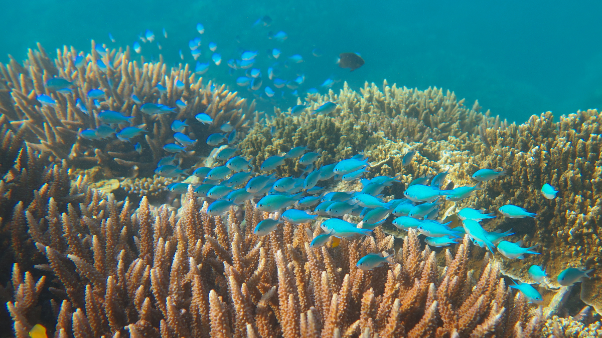
Queensland’s iconic tropical ecosystem rakes in around $5.2 billion annually, providing a full time wage for more than 64,000 individuals. Ignoring the dollars, the multitude of reefs provide are home for 1,500 species of fish, hundreds of types of coral, and 30 species of marine mammals.
The costs of not paying attention to the condition of this stretch of ocean could be catastrophic, with threats posed by changing climate, invading starfish, overfishing, and nutrient runoff. Impacts of its loss would echo not just around Australia, but around the world.
In Australia, our so-called ‘blue economy’ weighs in at a hefty $74 billion per year. We’re talking just under 5 per cent of the GDP, and hundreds of thousands of jobs. By 2025, this could be as high as $100 billion, money that trickles in from not just fishing, but transport, tourism, and offshore fossil fuel extraction.
Each has the capacity to affect another’s livelihood through their impact on the environment.
Wider afield, other industries such as agriculture can have an impact on the integrity of coastal marine ecosystems. Pollutants and sedimentation find their way into the oceans, to the detriment of its shallow meadows of sea grass and banks of coral forests.
Striking the right balance between competing sectors while knowing how each industry affects not just local waters but the oceans beyond our borders is tricky business requiring clear and respectful communication.
“Many stakeholders have found the eReefs Project useful,” says Baird.
“The federal and state governments have used eReefs data to generate report cards to communicate the Reef’s health. Governments have also used models to develop basin-specific pollution targets that optimise the improvement in reef water quality.”
A view from above – and below
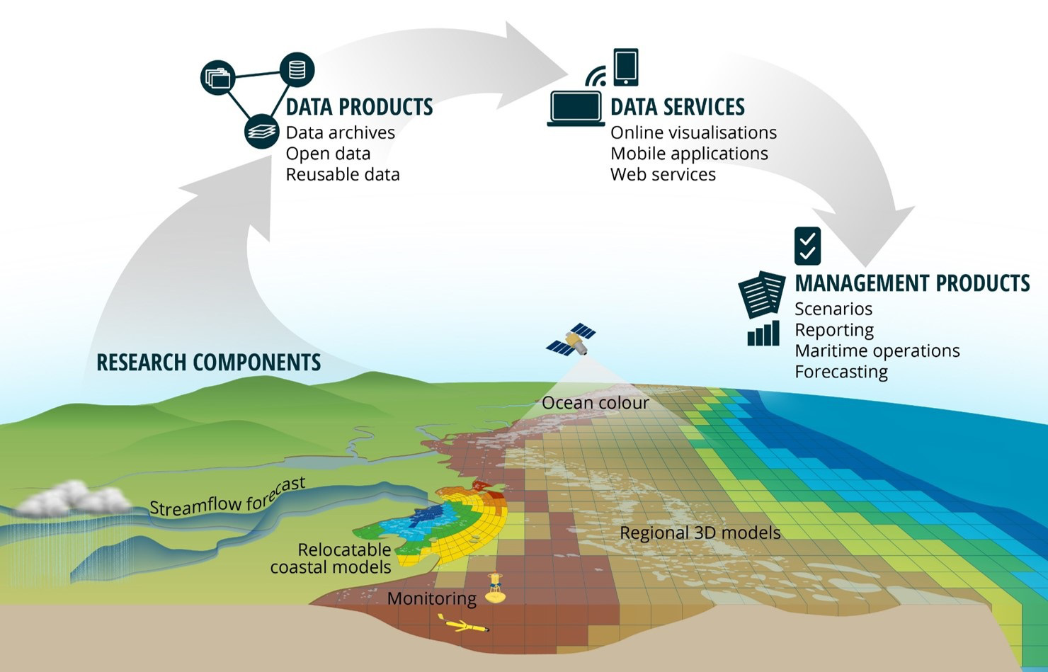
To collect the data, the program’s researchers use satellites to make colour observations from space. The colour images are corrected for the blurring effect of the atmosphere and the remaining colour or reflected light of the sea surface is then used in specially designed algorithms to determine the water quality. The colour of the sea surface reflects the composition of the water, which is influenced by varying concentrations of chlorophyll , particulate, and dissolved organic matter. The satellite colour observations are combined with hydrodynamic and biogeochemical models to build a more comprehensive picture of water quality changes along the Great Barrier Reef.
As useful as an angel’s view of the ocean is, the setting of the sun or an overcast day can draw the curtains on the satellite observations from space. What’s more, as any photographer knows, the perfect outdoor snapshot is all in the weather conditions. So when your camera captures light that’s filtered through kilometres of circulating air, it’s important to know exactly how the atmosphere might be affecting your picture.
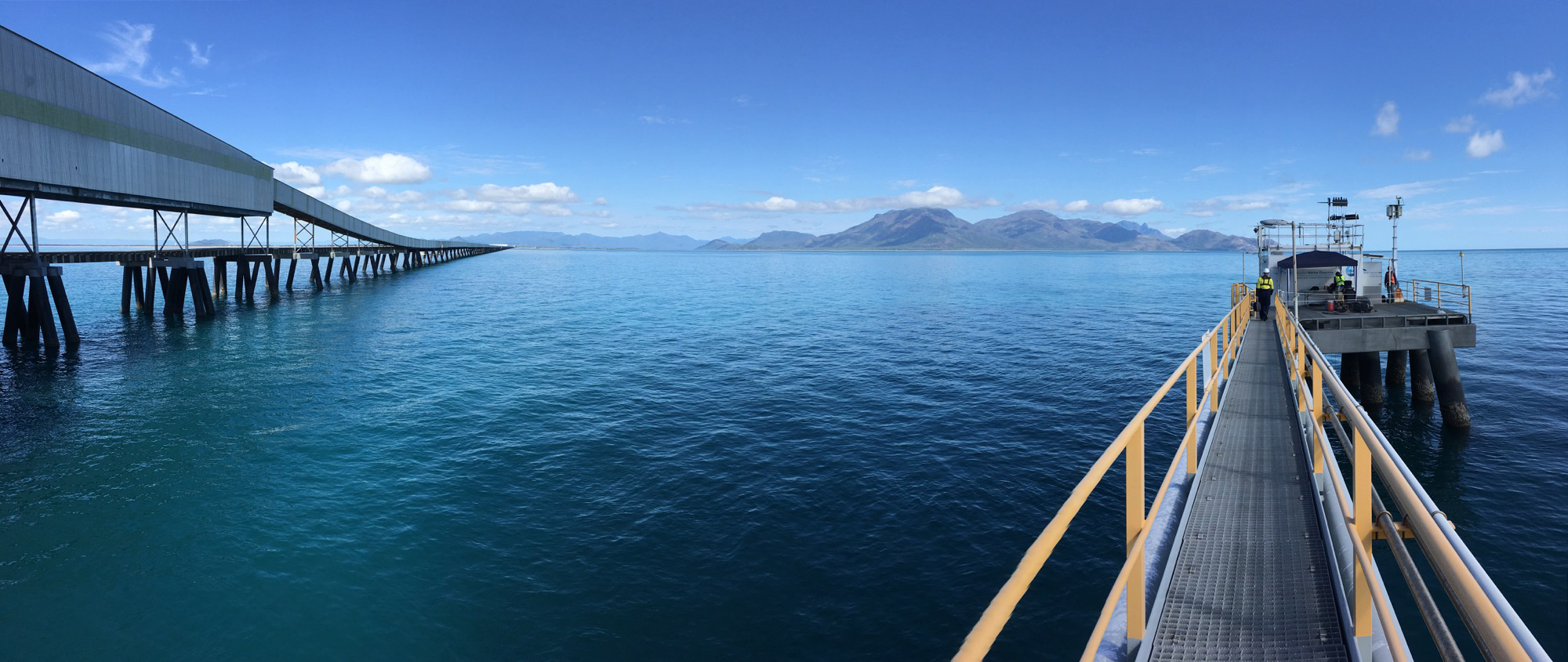
That’s why it pays to have a ground-based observatory like the one at Lucinda Jetty in far north Queensland. Stretching nearly 5.8 kilometres from the coast near the mouth of the Herbert River, it is operated by Queensland Sugar Limited as a bulk sugar terminal. Funded by CSIRO and the Integrated Marine Observing System (IMOS), a coastal observatory was established at the end of the jetty, the longest in the Southern Hemisphere. Not only does this make it popular for local anglers, it makes it a perfect spot to dip a few sensors into the Great Barrier Reef lagoon.
In its now five years of continued operation, the Lucinda Jetty Coastal Observatory has been used to validate satellite ocean colour observations. Submerged under five metres of sea water are sensors that measure physical and biogechemical properties such as absorption and scattering, as well as temperature, salinity , pressure, oxygen, turbidity and fluorescence.
Sensors above the surface capture information on the reflected light or colour of the water and monitor the properties of aerosols that influence how sunlight filters through the atmosphere. In addition, there are the usual run of meteorological instruments you might expect of an ocean-based observatory for measuring air pressure, wave height, wind speed and direction and air temperature.
The ground-based observatory is the only one of its kind south of the equator, combining atmospheric and marine observations that are used not just by the research community, but also by international space agencies, including NASA and European Space Agency.
“Continuous marine observations such as those collected at the Lucinda Jetty Coastal Observatory are critical to quantifying the performance of satellite observations and to help improve the predictive capabilities of the eReefs models,” says CSIRO senior research scientist Dr Thomas Schroeder, Facility Leader of the Lucinda Jetty Observatory.
The combined data from observations and modelling provides stakeholders with a far more accurate and far more complete picture of the condition of North Queensland’s coastal waters.
“The eReefs platform makes available data from a broad range of observation systems, including ground observations and satellite data,” says Baird.
This information is then made accessible through an online portal, turning a stream of data from the sky and the sea into an evolving picture of the north Queensland coast.
“One strength of the portal is the ability to ‘discover’ – through a metadata search engine – observation and modelling data related to one phenomenon, and then visualise these within the one system,” says Baird
Our local oceans are as ever changing as the tides. Monitoring shifts of their composition requires more than a boat and a wet finger – it demands a rich array of sophisticated sensors that can be the eyes, fingers and tastebuds, all working together to provide a more comprehensive view of our marine and coastal environment.