Far beneath the ocean waves, a treasure trove of secrets lies locked away in the sediments of the seafloor. Formed by geological, chemical and biological processes, sediments offer a long-term record of past ocean and climate conditions.
They can also capture carbon by entombing marine life that sinks down through the ocean.
We look at five things that ocean sediments – commonly known as ‘mud’ – can tell us. Let’s get sedimental!
Unlocking past ocean and climate conditions
Marine sediments offer a continuous record of ocean and climate conditions over time. Each year, deposits of new material settle onto the seafloor on top of the previous year’s sediments. Studying these sediments are scientists who ‘plug’ the seafloor for sediment cores. The longer the core they collect, the longer the window into the past.
During a 2017 voyage to Antarctica, scientists collected sediment cores from East Antarctica to help fill gaps in our climate record. As the climate has changed over time and CO2 levels have risen, much of this CO2 has been absorbed by the ocean. Microscopic organisms living in the ocean, and deposited in the sediments underneath, record these past changes in climate. As a result, this makes the sediments important sentinels of past climate.
This understanding is vital. The more we learn about past changes in our ocean and climate, the better we can prepare for the future.
Investigating past marine ecosystems
Sediments offer us the opportunity to investigate past marine life. Scientists do this by studying the DNA in sediments. This offers a novel approach to investigating past ecosystems over large timescales.
As the remains of marine organisms fall to the seafloor, they accumulate over time. This forms a continuous record of past communities in the sediment. Using DNA analysis, scientists can identify the species that are present. This includes species that don't fossilise and cannot be identified by visual observation.
During the 2017 voyage to Antarctica, scientists used this novel approach to get a better understanding of what species thrived around Antarctica in the past. This includes times when the climate was changing. Scientists then use this data to help predict what might happen to these species and ecosystems with future changes to our climate.
Tracking algal blooms through time
In 2018, Prof Gustaaf Hallegraeff from the University of Tasmania led a voyage onboard RV Investigator to collect sediment cores along the east coast of Tasmania. The objective was to investigate toxic algal blooms in the past by studying the plankton species in the cores.
The sediment cores collected covered a period of about 9000 years. This record nearly stretched back to the last ice age, when the seafloor was above water. Analysis of plankton in the sediments provided a significant increase in our knowledge of Australian plankton, with reliable data previously only available from 1940.
The sediment showed algal blooms had occurred relatively regularly over time but with an increasing frequency of blooms for some species in recent history. Scientists correlated this increase with climate and ocean warming. Furthermore, their analysis indicated that several new species were likely introduced via ballast water from ships.
Further, the research also provided detailed insights into past marine ecosystem composition over geological timescales.
Take a step back in time in this video of Prof Hallegraeff’s earlier research with CSIRO.
A record of a violent earth
Sediments can also tell us the story of cataclysmic events such as volcanic eruptions and tsunamis. Through study of seafloor sediments, the type and duration of volcanic eruptions – both above and below water – can be determined. Similarly, the presence of volcanic materials, such as pumice and ash, in a sediment record can provide markers for past volcanic eruptions and their power. This enables scientists to reconstruct eruption events from the past and better predict the potential impact of future eruptions.
In addition, RV Investigator and its predecessor, RV Southern Surveyor, have delivered several voyages along the Australian coastline to study undersea landslides that have the potential to generate tsunami. This research and analysis of the sediments collected allows scientists to determine the nature and power of previous undersea landslides. Importantly, this knowledge allows us to identify potential hazards for our coastal communities and take measures to mitigate risk.
Mapping geology beneath the ice
The geology of some areas of Antarctica is masked by thick ice and remain largely unexplored. However, as ice sheets move across the rock beneath, they erode and carry sediment from the rock, eventually dropping this into the ocean. The marine sediments that are formed can then be studied to determine the type of rock the ice travelled over.
During RV Investigator’s 2017 voyage to Antarctica, scientists from the University of Tasmania collected sediment cores along the Antarctic coast. They then used these to determine the geology of inland areas covered in thick ice. Analysing the sediment cores, scientists were also able to reconstruct past ice sheet formation. This showed how the ice had advanced and retreated in East Antarctica in the past.
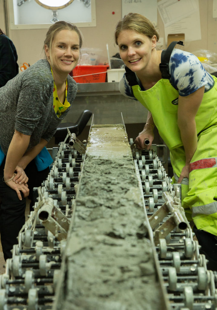
Plugging away for science
To study seafloor sediments, you need some special equipment and a special ship.
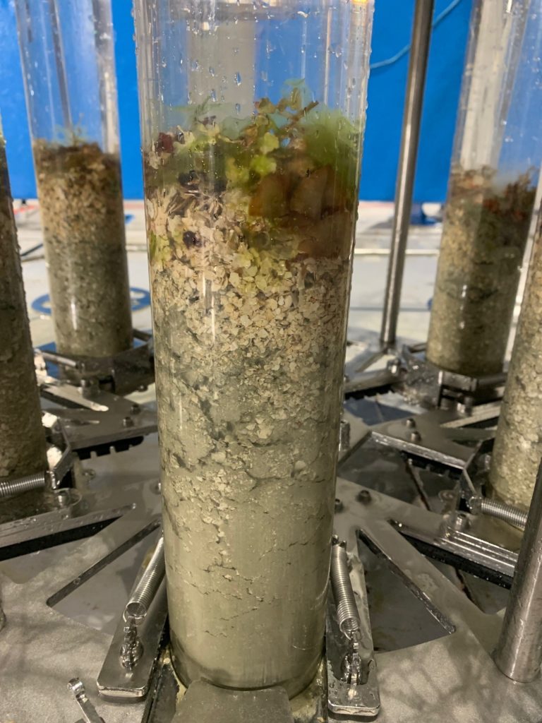
RV Investigator has a wide range of equipment to study seafloor sediments at depths of up to 6000 m. This includes sediment grabs, sleds and dredges, and a range of sediment corers, equipment used to capture a ‘plug’ of sediment from the seafloor. The grab bag of corers available includes: piston corers, box corers, gravity corers, multicorers and vibracorers. In addition, we even have a giant piston corer which can capture 24 m lengths of seafloor sediment from depths of 6000 m!
The ship also has brains to complement its brawn. Smart technology helps researchers survey the seafloor. This includes seafloor mapping equipment and a small-scale seismic acquisition system that can be used to map the structure and type of sediments beneath the seafloor.
Even deep ocean cameras can be used to give scientists a close-up view of sediments on the seafloor!
File under mud
Of course, the science doesn’t end when a voyage does. Universities and research partners like Geoscience Australia maintain massive core libraries of sediment from the ocean floor for future study.
Being a mud librarian offers a unique occupation to add to a CV!