Investigator has recently undertaken sea trials off the coast of Tasmania to test and calibrate around $20 million worth of scientific equipment in preparation for research voyages in 2015.
The manager of the Geophysical Survey and Mapping Team at CSIRO, Dr Tara Martin, said all onboard sonar systems were fully operational and delivering clear and impressive images.
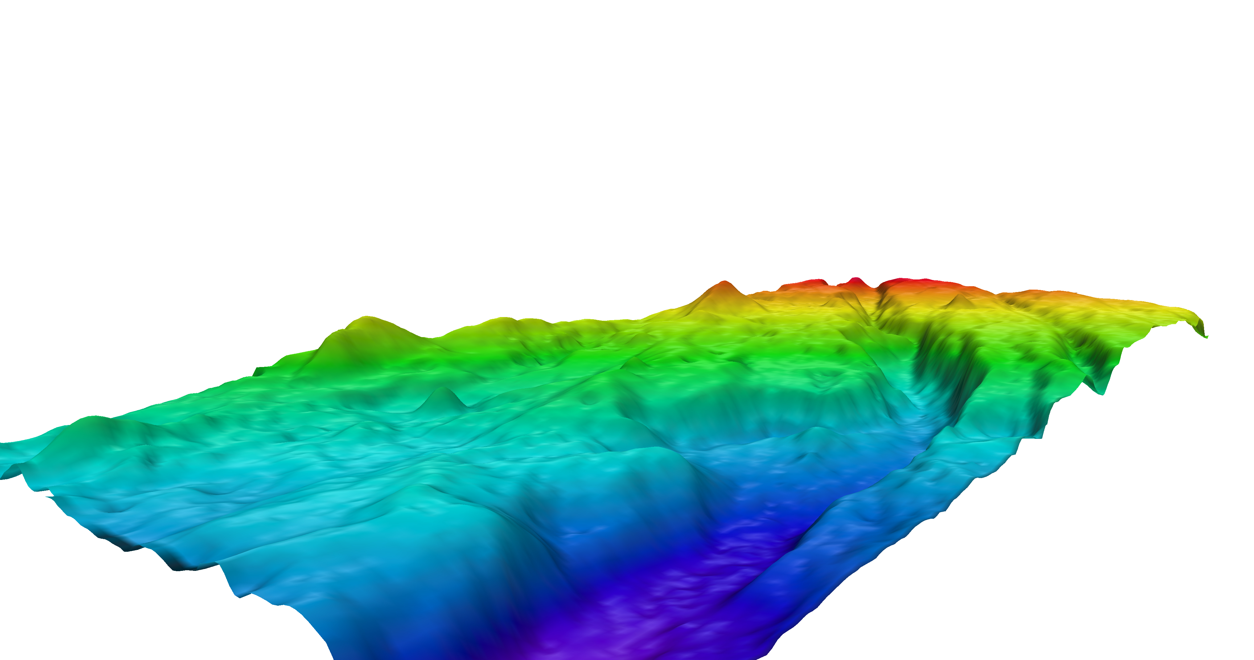
"Investigator is equipped with sonar that will map the sea floor in 3-D to any depth, and a sub-bottom profiling system that can look further up to 100 metres into the actual sea bed, to determine its composition," Dr Martin said.
"We've been heading out 120 nautical miles north east and south east of Hobart to test and calibrate a range of equipment and the sea floor data is being collected where ever we go.
"While there have previously been images of Tasmania's surrounding sea floor collected in sections, the data we're collecting is at higher resolution than ever before and will fill in a lot of gaps for local fishermen, the maritime industry and scientists.
"The sonar on the previous research vessel, Southern Surveyor, operated to 3000 metres and there are waters around Tasmania much deeper than this."
All of the data collected on board Investigator will be made public as soon as practical.
Under direction of an independent Steering Committee, the Marine National Facility is owned and operated by CSIRO on behalf of the nation.
The Welcome to Port Celebrations for RV Investigator will be held on the CSIRO Wharf at Battery Point on Friday 12 December 2014, which will mark the official handover of the ship from CSIRO to the Marine National Facility for operation.
The public are invited to come down to the CSIRO Wharf from 3pm to 8pm, where there will be science education activities for all ages, science equipment on display and the chance to win a ship tour of RV Investigator. The event is free.