The $11.4 million Northern Rivers Resilience Initiative aimed to help the Australian Government understand the drivers behind the unprecedented flood events in February-March 2022 and develop community-supported solutions for flood mitigation and resilience investment.
The National Emergency Management Agency (NEMA) engaged Australia’s national science agency CSIRO to support the Initiative, which considered climate, catchment and hydrological systems, and the broader influences of land-use practice and infrastructure.
The final report for the project was publicly released on 30 June, 2026. It was the culmination of four years of extensive community engagement, data collection, the formulation of robust flood mitigation options, high-resolution hydrodynamic modelling, extensive review of historical flood events and flood mitigation scenario analysis.
The modelling undertaken showed that the impact of large floods could be reduced across the Richmond River catchment with strategically located water detentions and other flood mitigation measures. The final report provides a scientific basis for informed decision-making and future flood resilience investments in the Northern Rivers region.
Scenario testing and recommendations for future flood mitigation activities in the Richmond River catchment in the Northern Rivers region, NSW, Australia
The final report for the project was delivered to NEMA on 30 June, 2026.
 The Northern Rivers Resilience Initiative consisted of two phases:
1. Rapid review and assessment phase – the first six months (July to November 2022) identified and prioritised existing project proposals. It analysed the most effective intervention options for allocation of the Australian Government’s $150 million funding and characterised the catchment and clmate conditions which led to the 2022 floods. Residents and councils, in each of the seven flood-affected Local Government Areas in the region (Ballina, Byron, Clarence Valley, Kyogle, Lismore, Richmond Valley and Tweed) were consulted to help identify and prioritise the most effective intervention options.
Outcome – CSIRO completed the rapid review and assessment phase and submitted two related reports to NEMA on 30 November 2022. These reports and a full list of project recommendations were then considered by the Federal and NSW governments.
On 23 February 2023, the first 16 projects totalling $50 million were announced. These included combined upgrades to pumps and pump stations in Lismore, a new pump system to assist drainage in East Murwillumbah and installation of box culverts through a riverbank levee to improve local drainage in Grafton.
On 28 July 2023, the second 20 projects totalling $100 million were announced. These included raising two low bridges at Tatham to improve access between Casino and Coraki during flood events and widening the Browns Creek flood channel at Lismore.
CSIRO and NEMA completed phase one of the Northern Rivers Resilience Initiative project with the allocation of the total $150 million Australian Government funds for flood mitigation and resilience projects in the Northern Rivers region.
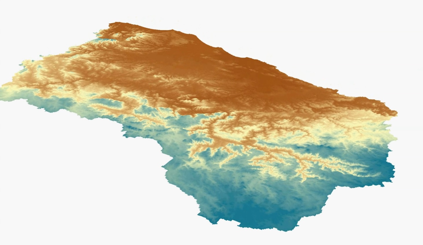
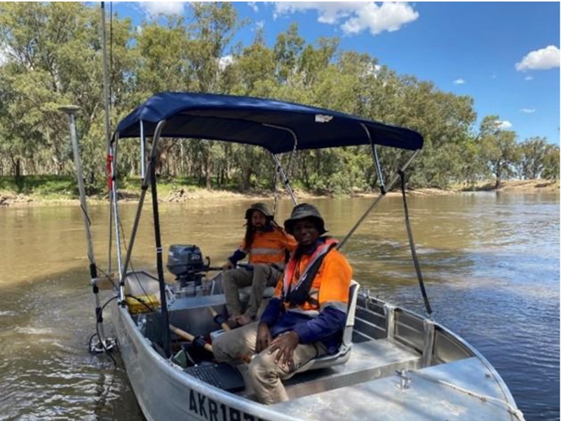
2. Detailed data collection and modelling. This work generated Light Detection and Ranging (LiDAR) data (using planes) to inform spatial analysis for the entire Northern Rivers region. River bathymetry (using boats) was also collected for the Richmond and Tweed rivers and parts of the Brunswick. All this high-quality data was used to underpin a detailed hydrodynamic model for the Richmond River catchment.
Outcome – The quality assessed LiDAR and Bathymetry datasets became publicly available on 28 June 2024 through the Geoscience Australia Elvis website. This was the first time high-quality LiDAR and river floor mapping data (for three rivers) had been captured and made available for the Northern Rivers region. Such a comprehensive overview of the river systems in the NSW Northern Rivers region provides an evidence base for future planning, including reducing the impacts of floods.
The Model and flood mitigation options. The LiDAR and river bathymetry data were essential inputs for the detailed hydrodynamic model for the Richmond River catchment. The hydrodynamic model was developed and validated against multiple observed datasets. The model accurately represented water flow, depth, and velocity across the Richmond River catchment (more than 7000 km²). The model was finalised and a technical report (outlining the implementation and validation for the Richmond River catchment) was made publicly available on 30 June 2025.
The hydrodynamic model was then used by CSIRO to test and investigate further flood mitigation interventions for the Northern Rivers region and the final report was delivered to NEMA on 30 June 2026. The development and selection of mitigation options was done in conjunction with community and State, Federal, and Local Government. The two bundles of flood mitigation options were designed to represent a smaller set of interventions in the first bundle (called Bundle 1) and a larger number of interventions covered in the second bundle (called Bundle 2). Across all three events modelled (2008, 2017 and 2022), the second, more aggressive, bundle of flood mitigation measures (which includes 10 detention basins) was more effective at reducing flooding across the catchment.
Modelling showed significant reductions in flood peaks, inundation extent, and depth across the Richmond River catchment were possible. This included:
- Water levels at key gauges (Lismore, Casino, Coraki, Ballina) significantly reduced, especially with Bundle 2.
- Flood peaks at Lismore reduced by up to 2.37 m in 2008, 1.40 m in 2017, and 2.07m in February 2022 with Bundle 2.
- Flood peaks reduced by up to 2.76 m at Casino and 0.84 m at Kyogle in the largest events.
Richmond Catchment Scenario Modelling
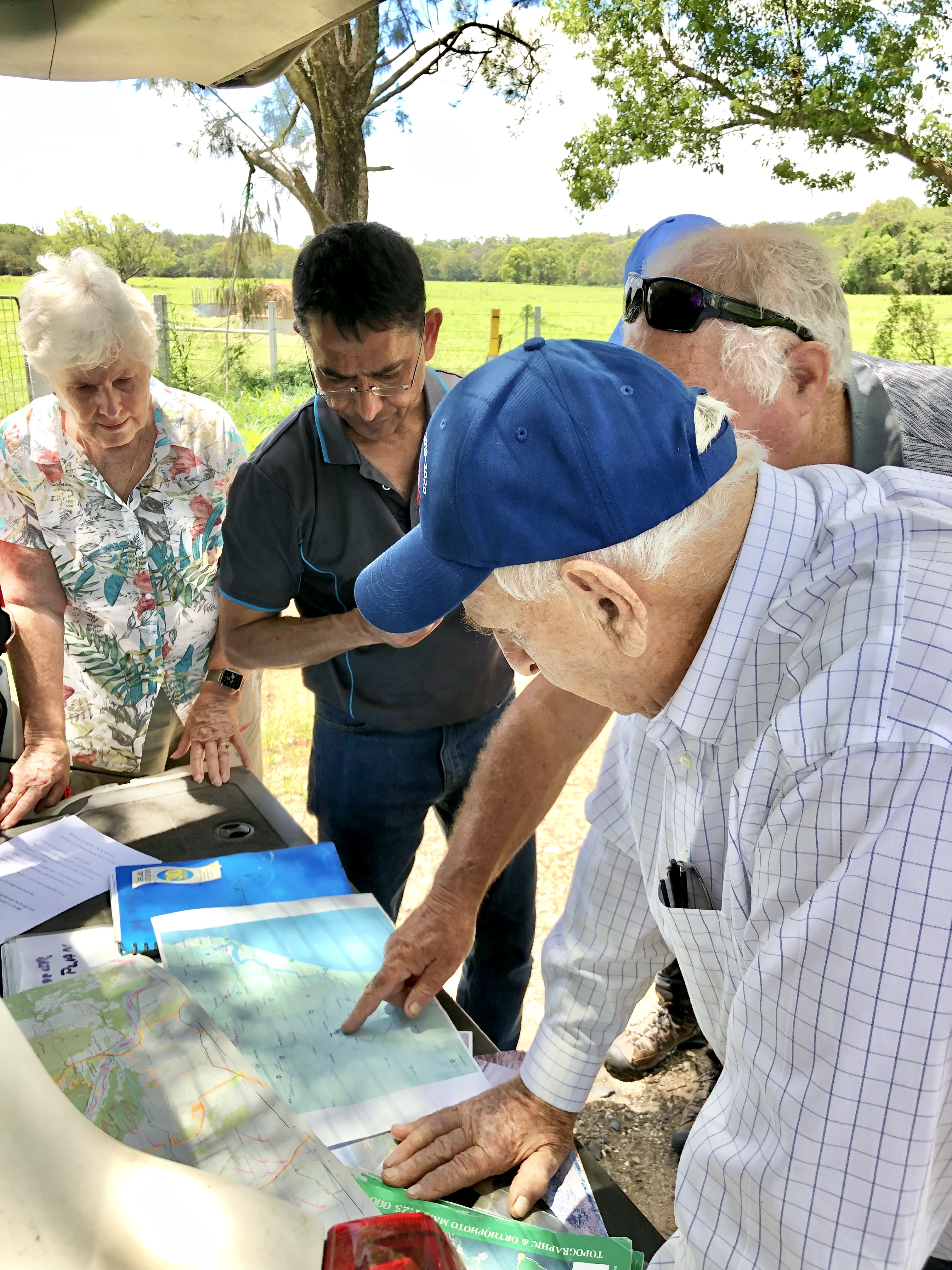
Community and stakeholder engagement
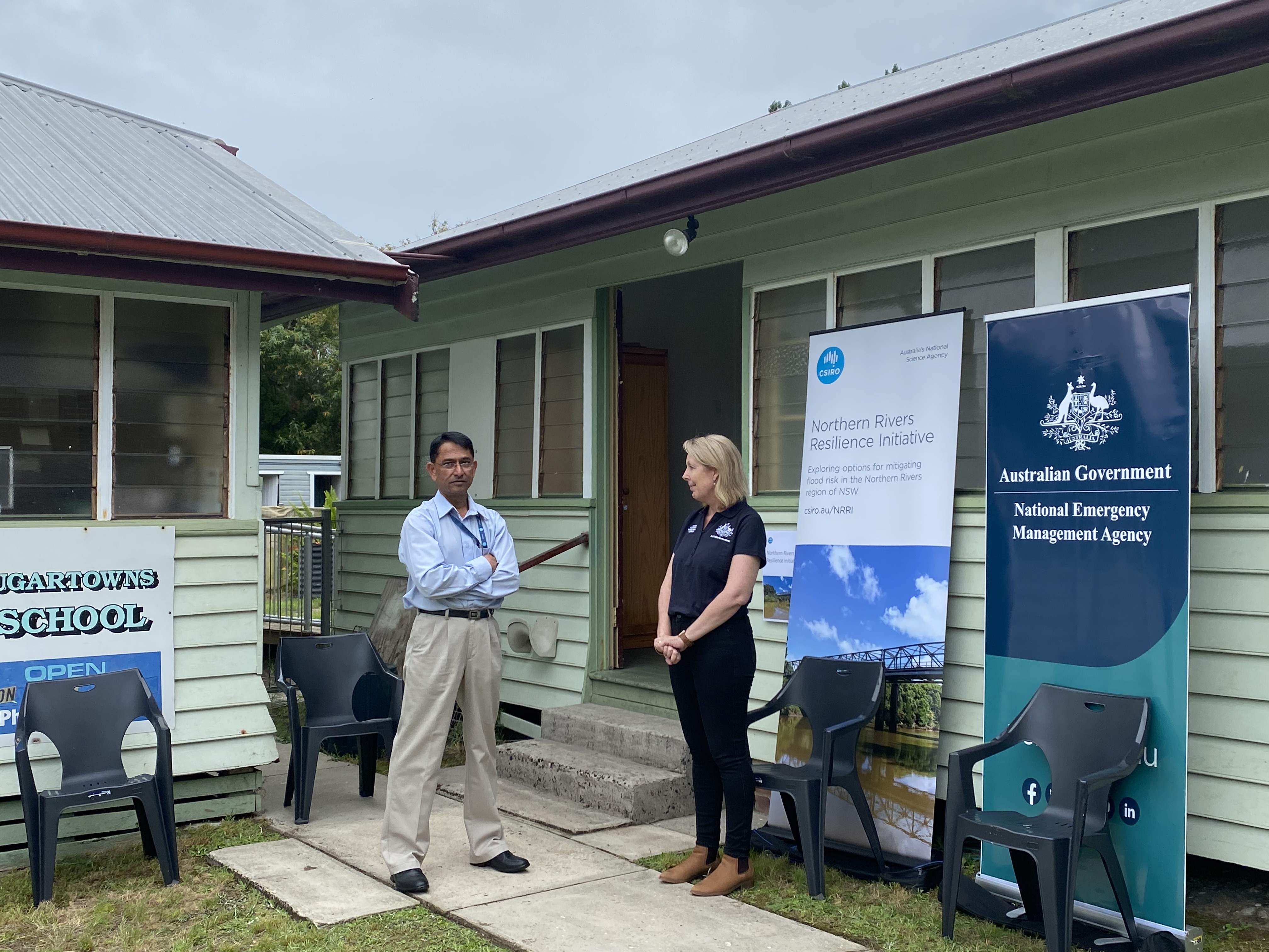
A core part of both phase one and phase two of the project has been to engage with residents in flood-affected areas to seek their views regarding priorities for investment. NEMA and CSIRO will once again return to the region in July 2026 to discuss the final report findings with the community at drop-in sessions. You can register via the NEMA website.
CSIRO and NEMA provide regular updates on NRRI progress on our websites as well as regular updates to project governance and advisory panels, the Northern Rivers Joint Organisation (NRJO), local councils, stakeholders and communities. For further details please email nrri@csiro.au or NRRI@nema.gov.au.
Frequently asked questions
From your analysis so far, what led to the extreme 2022 flood event in the Northern Rivers region?
Between the 23 February and 1 March, the highest daily rainfall totals were felt in most parts of the Richmond, Tweed and Brunswick areas. Conditions were already significantly wetter than average across the Northern Rivers region with rainfall totals, soil moisture and groundwater levels remaining above their 75th percentile during the two months preceding the flood. Extreme rainfalls translated into record high stream flows, volumes and water levels. Major flood levels were exceeded by more than 2 metres in several locations including in Lismore where the flood reached a record 14.37 metres.
How were flood mitigation scenarios developed for the Richmond Catchment?
Flood mitigation scenarios were created through two rounds of community and council consultations, where feedback was collected and used to design and refine possible interventions. The flood mitigation scenarios were effectively developed by the local councils and majority of the community members with technical input from CSIRO.
What supports the flood modelling in this project?
High-resolution LiDAR and river bathymetry data were collected and used to build a detailed hydrodynamic model for the Richmond River catchment. Detailed hydrodynamic models also need a lot of other data including fine spatial and temporal resolution rainfall surfaces, soils information and hydraulic properties, vegetation information, etc.
What did the hydrodynamic modelling show?
The modelling showed that strategically located water detentions and related flood mitigation measures reduced flood peaks, inundation extent and flood depth across the catchment. Across all three historical flood events modelled in 2008, 2017 and 2022, the larger bundle of measures (known as bundle 2) delivered the greatest reductions in flood impacts.
This included:
- Lismore: The measures did not stop flooding completely, but they did significantly reduce flood heights and impacts.
- Kyogle: The measures reduced flood heights and impacts in Kyogle, but to a lesser extent than in downstream towns. While the measures did not stop flooding, the modelled events were less severe, with further improvements possible with additional upstream detention basins.
- Woodburn and Coraki: The measures reduced flood depth and severity, particularly in the larger events modelled, but benefits were more limited than upstream towns and slightly influenced by tidal levels. Results showed that flooding still occurred, but the severity was reduced, with floods shorter in duration and less damaging overall.
- Casino: The measures had a substantial impact on flooding in Casino, resulting in significant reductions in flood height and extent.
- Ballina: The measures provided meaningful reductions during the major flooding events modelled and reduced flood depth and extent substantially. Limited benefits were seen in smaller flood events when there is no major landscape inundation.
What are detention storages/basins?
Detention basin and detention storage mean the same thing in flood mitigation literature. Both terms relate to structures that hold back floodwater temporarily during an event and release it safely after the flood peak to reduce downstream flooding.
Will the government continue to use the hydrodynamic model?
NEMA will continue working with CSIRO and the NSW Government to consider future uses of the model, including how it can support ongoing resilience planning, hazard risk reduction work and evidence-based decision-making for the Richmond River catchment.
Does this mean flood mitigation works will now be built?
The final report identifies options that could reduce flood impacts, but further work is needed, including detailed analysis, impact assessments and design work, subject to funding decisions. On the same day the report was publicly released, the Australian and NSW governments announced $3 million in combined funding to progress the NRRI findings. This includes the start of a detailed scoping study. This study will assess the technical, environmental, economic and social feasibility of potential interventions and help inform future investment decisions.
How can the public access and download the LiDAR and bathymetry data?
All the LiDAR and bathymetry data has been made available on the Geoscience Australia website. The ELVIS webpage provides step by step guidance to access and download the data for the area of interest. Almost all topography and bathymetry/seabed data collected by Australian agencies is made available to users through this website.
How can the LiDAR and bathymetry data be used by councils?
The data forms the critical scientific evidence base that can be used by the NSW Government, local councils, and non-government organisations for a range of other purposes including:
- land use
- transport and housing planning
- environmental and ecological studies
- hydrological assessments, and
- flood mitigation strategies and plans for the Northern Rivers region.
Why did you only develop a detailed hydrodynamic model for the Richmond River Catchment?
The focus on Richmond arose from the continual incidence of flooding and likely compounding impacts that come from a changed climate and hydrology. Lessons from the NRRI project will be applicable across the region. The LiDAR and river bathymetry data form the critical scientific evidence base that can be used by the NSW Government and local councils to inform future flood mitigation strategies and plans for all local government areas in the Northern Rivers region.
What were the long-term goals of the project?
The aim was to develop recommendations to inform planning resilience and readiness activities to reduce the effects of future flooding disasters in the Northern Rivers region. CSIRO will continue to communicate and work closely with the councils and the community. The final report demonstrated that mitigation measures reduce flood impacts, but further analysis is required before any on-ground implementation.This will include a detailed business case, cost-benefit analysis, environmental approvals, geotechnical analysis, detailed structural design, Australian and state government policy clearance, as well as future funding.
The $11.4 million Northern Rivers Resilience Initiative aimed to help the Australian Government understand the drivers behind the unprecedented flood events in February-March 2022 and develop community-supported solutions for flood mitigation and resilience investment.
The National Emergency Management Agency (NEMA) engaged Australia’s national science agency CSIRO to support the Initiative, which considered climate, catchment and hydrological systems, and the broader influences of land-use practice and infrastructure.
The final report for the project was publicly released on 30 June, 2026. It was the culmination of four years of extensive community engagement, data collection, the formulation of robust flood mitigation options, high-resolution hydrodynamic modelling, extensive review of historical flood events and flood mitigation scenario analysis.
The modelling undertaken showed that the impact of large floods could be reduced across the Richmond River catchment with strategically located water detentions and other flood mitigation measures. The final report provides a scientific basis for informed decision-making and future flood resilience investments in the Northern Rivers region.
Scenario testing and recommendations for future flood mitigation activities in the Richmond River catchment in the Northern Rivers region, NSW, Australia
The final report for the project was delivered to NEMA on 30 June, 2026.
The Northern Rivers Resilience Initiative consisted of two phases:
1. Rapid review and assessment phase – the first six months (July to November 2022) identified and prioritised existing project proposals. It analysed the most effective intervention options for allocation of the Australian Government’s $150 million funding and characterised the catchment and clmate conditions which led to the 2022 floods. Residents and councils, in each of the seven flood-affected Local Government Areas in the region (Ballina, Byron, Clarence Valley, Kyogle, Lismore, Richmond Valley and Tweed) were consulted to help identify and prioritise the most effective intervention options.
Outcome – CSIRO completed the rapid review and assessment phase and submitted two related reports to NEMA on 30 November 2022. These reports and a full list of project recommendations were then considered by the Federal and NSW governments.
On 23 February 2023, the first 16 projects totalling $50 million were announced. These included combined upgrades to pumps and pump stations in Lismore, a new pump system to assist drainage in East Murwillumbah and installation of box culverts through a riverbank levee to improve local drainage in Grafton.
On 28 July 2023, the second 20 projects totalling $100 million were announced. These included raising two low bridges at Tatham to improve access between Casino and Coraki during flood events and widening the Browns Creek flood channel at Lismore.
CSIRO and NEMA completed phase one of the Northern Rivers Resilience Initiative project with the allocation of the total $150 million Australian Government funds for flood mitigation and resilience projects in the Northern Rivers region.
2. Detailed data collection and modelling. This work generated Light Detection and Ranging (LiDAR) data (using planes) to inform spatial analysis for the entire Northern Rivers region. River bathymetry (using boats) was also collected for the Richmond and Tweed rivers and parts of the Brunswick. All this high-quality data was used to underpin a detailed hydrodynamic model for the Richmond River catchment.
Outcome – The quality assessed LiDAR and Bathymetry datasets became publicly available on 28 June 2024 through the Geoscience Australia Elvis website. This was the first time high-quality LiDAR and river floor mapping data (for three rivers) had been captured and made available for the Northern Rivers region. Such a comprehensive overview of the river systems in the NSW Northern Rivers region provides an evidence base for future planning, including reducing the impacts of floods.
The Model and flood mitigation options. The LiDAR and river bathymetry data were essential inputs for the detailed hydrodynamic model for the Richmond River catchment. The hydrodynamic model was developed and validated against multiple observed datasets. The model accurately represented water flow, depth, and velocity across the Richmond River catchment (more than 7000 km²). The model was finalised and a technical report (outlining the implementation and validation for the Richmond River catchment) was made publicly available on 30 June 2025.
The hydrodynamic model was then used by CSIRO to test and investigate further flood mitigation interventions PDF (2 MB) for the Northern Rivers region and the final report PDF (13 MB) was delivered to NEMA on 30 June 2026. The development and selection of mitigation options was done in conjunction with community and State, Federal, and Local Government. The two bundles of flood mitigation options were designed to represent a smaller set of interventions in the first bundle (called Bundle 1) and a larger number of interventions covered in the second bundle (called Bundle 2). Across all three events modelled (2008, 2017 and 2022), the second, more aggressive, bundle of flood mitigation measures (which includes 10 detention basins) was more effective at reducing flooding across the catchment.
Modelling showed significant reductions in flood peaks, inundation extent, and depth across the Richmond River catchment were possible. This included:
- Water levels at key gauges (Lismore, Casino, Coraki, Ballina) significantly reduced, especially with Bundle 2.
- Flood peaks at Lismore reduced by up to 2.37 m in 2008, 1.40 m in 2017, and 2.07m in February 2022 with Bundle 2.
- Flood peaks reduced by up to 2.76 m at Casino and 0.84 m at Kyogle in the largest events.
Richmond Catchment Scenario Modelling
Community and stakeholder engagement
A core part of both phase one and phase two of the project has been to engage with residents in flood-affected areas to seek their views regarding priorities for investment. NEMA and CSIRO will once again return to the region in July 2026 to discuss the final report findings with the community at drop-in sessions. You can register via the NEMA website.
CSIRO and NEMA provide regular updates on NRRI progress on our websites as well as regular updates to project governance and advisory panels, the Northern Rivers Joint Organisation (NRJO), local councils, stakeholders and communities. For further details please email nrri@csiro.au or NRRI@nema.gov.au.
Frequently asked questions
From your analysis so far, what led to the extreme 2022 flood event in the Northern Rivers region?
Between the 23 February and 1 March, the highest daily rainfall totals were felt in most parts of the Richmond, Tweed and Brunswick areas. Conditions were already significantly wetter than average across the Northern Rivers region with rainfall totals, soil moisture and groundwater levels remaining above their 75th percentile during the two months preceding the flood. Extreme rainfalls translated into record high stream flows, volumes and water levels. Major flood levels were exceeded by more than 2 metres in several locations including in Lismore where the flood reached a record 14.37 metres.
How were flood mitigation scenarios developed for the Richmond Catchment?
Flood mitigation scenarios were created through two rounds of community and council consultations, where feedback was collected and used to design and refine possible interventions. The flood mitigation scenarios were effectively developed by the local councils and majority of the community members with technical input from CSIRO.
What supports the flood modelling in this project?
High-resolution LiDAR and river bathymetry data were collected and used to build a detailed hydrodynamic model for the Richmond River catchment. Detailed hydrodynamic models also need a lot of other data including fine spatial and temporal resolution rainfall surfaces, soils information and hydraulic properties, vegetation information, etc.
What did the hydrodynamic modelling show?
The modelling showed that strategically located water detentions and related flood mitigation measures reduced flood peaks, inundation extent and flood depth across the catchment. Across all three historical flood events modelled in 2008, 2017 and 2022, the larger bundle of measures (known as bundle 2) delivered the greatest reductions in flood impacts.
This included:
- Lismore: The measures did not stop flooding completely, but they did significantly reduce flood heights and impacts.
- Kyogle: The measures reduced flood heights and impacts in Kyogle, but to a lesser extent than in downstream towns. While the measures did not stop flooding, the modelled events were less severe, with further improvements possible with additional upstream detention basins.
- Woodburn and Coraki: The measures reduced flood depth and severity, particularly in the larger events modelled, but benefits were more limited than upstream towns and slightly influenced by tidal levels. Results showed that flooding still occurred, but the severity was reduced, with floods shorter in duration and less damaging overall.
- Casino: The measures had a substantial impact on flooding in Casino, resulting in significant reductions in flood height and extent.
- Ballina: The measures provided meaningful reductions during the major flooding events modelled and reduced flood depth and extent substantially. Limited benefits were seen in smaller flood events when there is no major landscape inundation.
What are detention storages/basins?
Detention basin and detention storage mean the same thing in flood mitigation literature. Both terms relate to structures that hold back floodwater temporarily during an event and release it safely after the flood peak to reduce downstream flooding.
Will the government continue to use the hydrodynamic model?
NEMA will continue working with CSIRO and the NSW Government to consider future uses of the model, including how it can support ongoing resilience planning, hazard risk reduction work and evidence-based decision-making for the Richmond River catchment.
Does this mean flood mitigation works will now be built?
The final report identifies options that could reduce flood impacts, but further work is needed, including detailed analysis, impact assessments and design work, subject to funding decisions. On the same day the report was publicly released, the Australian and NSW governments announced $3 million in combined funding to progress the NRRI findings. This includes the start of a detailed scoping study. This study will assess the technical, environmental, economic and social feasibility of potential interventions and help inform future investment decisions.
How can the public access and download the LiDAR and bathymetry data?
All the LiDAR and bathymetry data has been made available on the Geoscience Australia website. The ELVIS webpage provides step by step guidance to access and download the data for the area of interest. Almost all topography and bathymetry/seabed data collected by Australian agencies is made available to users through this website.
How can the LiDAR and bathymetry data be used by councils?
The data forms the critical scientific evidence base that can be used by the NSW Government, local councils, and non-government organisations for a range of other purposes including:
- land use
- transport and housing planning
- environmental and ecological studies
- hydrological assessments, and
- flood mitigation strategies and plans for the Northern Rivers region.

Why did you only develop a detailed hydrodynamic model for the Richmond River Catchment?
The focus on Richmond arose from the continual incidence of flooding and likely compounding impacts that come from a changed climate and hydrology. Lessons from the NRRI project will be applicable across the region. The LiDAR and river bathymetry data form the critical scientific evidence base that can be used by the NSW Government and local councils to inform future flood mitigation strategies and plans for all local government areas in the Northern Rivers region.
What were the long-term goals of the project?
The aim was to develop recommendations to inform planning resilience and readiness activities to reduce the effects of future flooding disasters in the Northern Rivers region. CSIRO will continue to communicate and work closely with the councils and the community. The final report demonstrated that mitigation measures reduce flood impacts, but further analysis is required before any on-ground implementation.This will include a detailed business case, cost-benefit analysis, environmental approvals, geotechnical analysis, detailed structural design, Australian and state government policy clearance, as well as future funding.
Related to this page
- Final Report: Scenario testing and recommendations for future flood mitigation activities in the Richmond River catchment in the Northern Rivers region, NSW, Australia. PDF (13 MB)
- The blueprint to reducing Lismore floods by up to two metres
- People power: how scientists built an accurate, catchment-wide flood model
- Meet our hydrologist: Dr Jai Vaze
- CSIRO Project Leader Jai Vaze