The Tasmania Parks and Wildlife Service (PWS) is responsible for managing shipwrecks and downed aircraft sites in Tasmanian waters on behalf of the Australian Government.
There are almost 1,000 ships lost in Tasmanian waters and many of these wrecks only have rough locations recorded. This makes it hard to manage them when their condition and exact location is unknown.
In November 2025, PWS Historic Heritage Manager Annita Waghorn joined an underwater survey voyage on research vessel (RV) Investigator, which is operated by CSIRO, Australia’s national science agency. The main goals of the voyage were to explore two underwater Indigenous cultural landscapes in NSW waters and survey shipwrecks along Australia’s east coast including Tasmania’s coast.
The voyage brought together researchers and heritage experts from CSIRO, the Australian Government’s Department of Climate Change, Energy, the Environment and Water, the Australian National Maritime Museum, the University of Adelaide, Elders and Traditional Owners of Sea Country, and agencies from Tasmania, New South Wales and South Australia.
In collaboration with CSIRO mapping experts and technicians, the team used multibeam sonar to map the seafloor and investigate the condition and location of historic wrecks, as well as map underwater Indigenous cultural landscapes.
While in Tasmanian waters, they surveyed ten locations where shipwrecks were thought to be. No wrecks were found at eight of these locations, demonstrating the challenges of researching and protecting such sites.
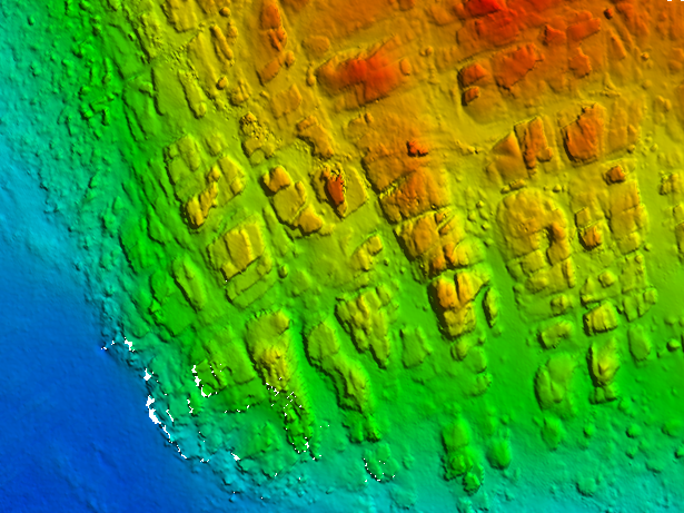
The team also surveyed the SS Tasman wreck site off the Hippolytes on the Tasman Peninsula. Previously, there have been site plans and models of the wreck made by private divers who first located and identified it. However, this is the first time the wreck site has been mapped using high-resolution sonar.
The new scans give managers more information about how the wreck is lying on the seafloor and will help with the management of the site.
This voyage helped build stronger connections between all the participating organisations and will assist in developing plans for further surveys of Tasmanian shipwrecks.
Matt Kimber, Group Leader with the CSIRO Marine National Facility, said the voyage was an important opportunity for CSIRO to connect with key stakeholders who can benefit from the advanced seafloor mapping capabilities offered by RV Investigator.
“By bringing together heritage experts, researchers and Traditional Owners, this voyage demonstrated how RV Investigator’s mapping capabilities can support the protection and management of underwater heritage,” Mr Kimber said.
“The CSIRO team was privileged to help bring these hidden landscapes and shipwrecks into clearer view.”
Data from this voyage will add to the Australasian Underwater Cultural Heritage Database and form part of the Australian contribution to the international Seabed 2030 program.
This research was supported by a grant of sea time on RV Investigator from the CSIRO Marine National Facility. CSIRO is currently inviting Australian researchers to apply for fully funded grants of sea time on RV Investigator to conduct research in 2028-29.
Originally published by the Tasmania Parks and Wildlife Service