[Music plays and images of people in rural and scientific work appear in shapes and move around the screen]
Narrator: Throughout history the secrets of our soil and landscape have remained mostly hidden.
The need to make effective decisions critical to the economic, social and environmental future of Australia is greater than ever. Our soil and landscapes play a vital role.
[Images coalesce into a map of Australia]
To navigate these issues, Australia needs access to better scientific data and information.
[Image changes to show a grid move over map of Australia, bar of light suggests scanning the map]
Now there is a new way to understand our landscapes, the Soil and Landscape Grid of Australia.
[Image changes and text appears: Soil and Landscape Grid of Australia, images of land and sky appear beneath the map, sectors of the map light up]
The first, comprehensive, high-resolution digital maps of the country’s most important soil and landscape attributes… downloadable and free.
[Camera zooms into map revealing streams of data]
This national scientific collaboration weaves together digital mapping technologies with our rich but disparate and fragmented data into a tapestry of relevant and consistent soil and landscape information.
[Image changes to show depict data modelling; image appears of the earth wrapped in a grid]
Built to global best-practice specifications, this digital information framework is designed to complement existing systems and to hold historical, current and future data from emerging scientific technologies.
[Images changes to show computer modelled data, images depicts data raining on grid]
The Grid is the new foundation for digital soil and landscape data, encapsulating soil measurements from remote and onsite sensing, and results from laboratory analysis, with advanced modelling and mapping.
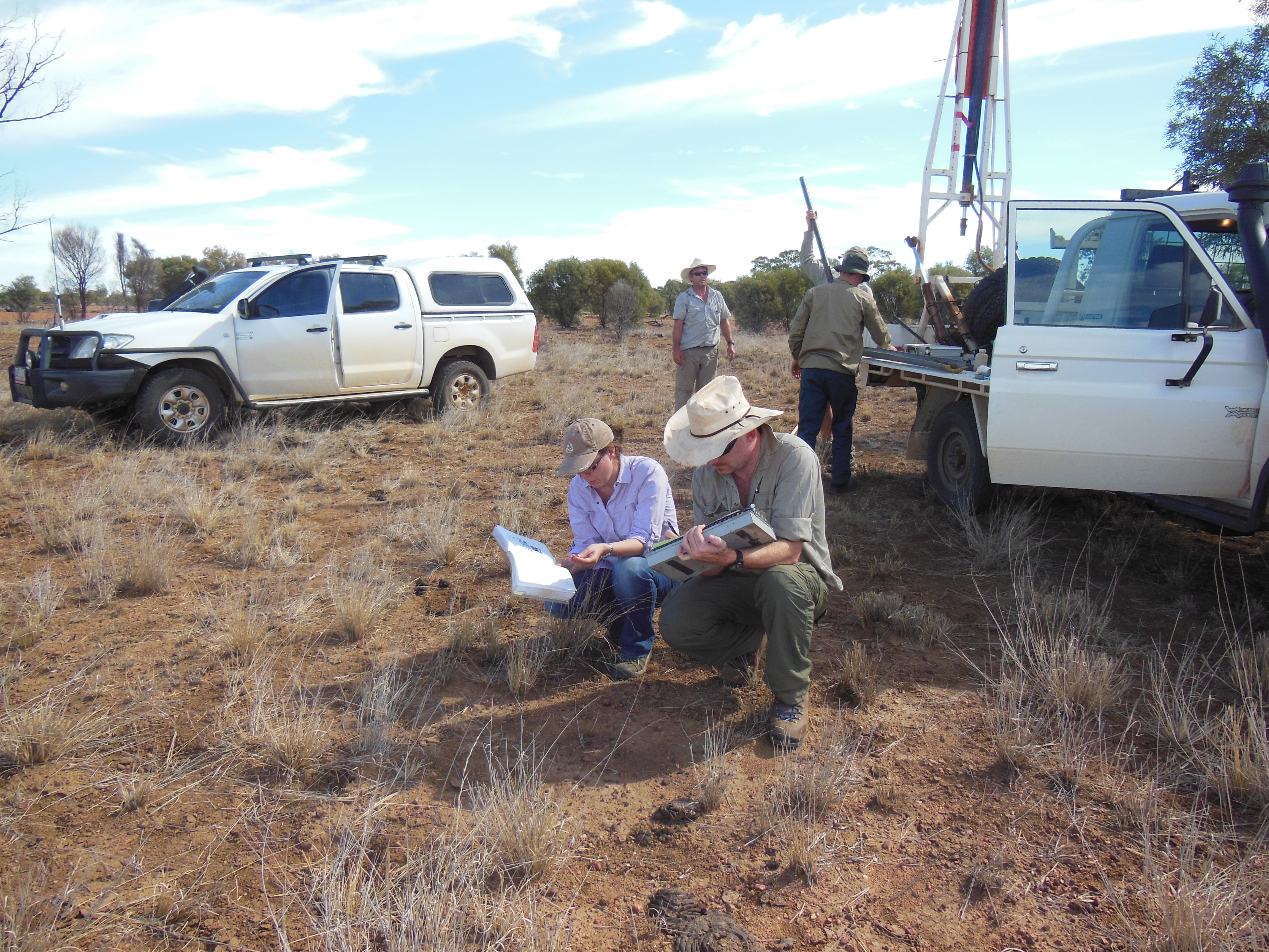
[Image changes to show a satellite, scientific testing at rural/industrial sites, mathematical equations, graphs]
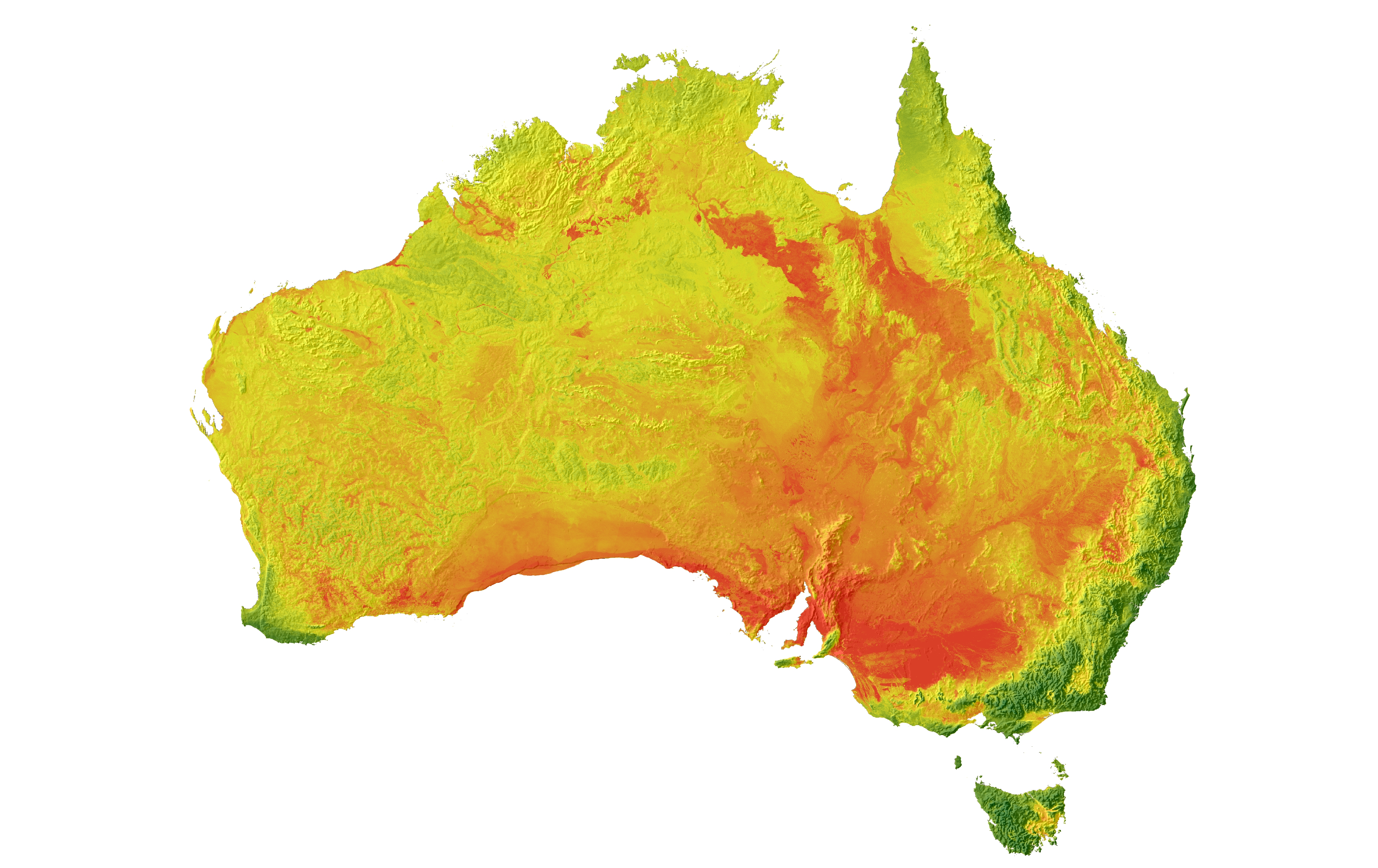
The Soil and Landscape Grid of Australia is composed of over two billion pixels covering the entire continent.
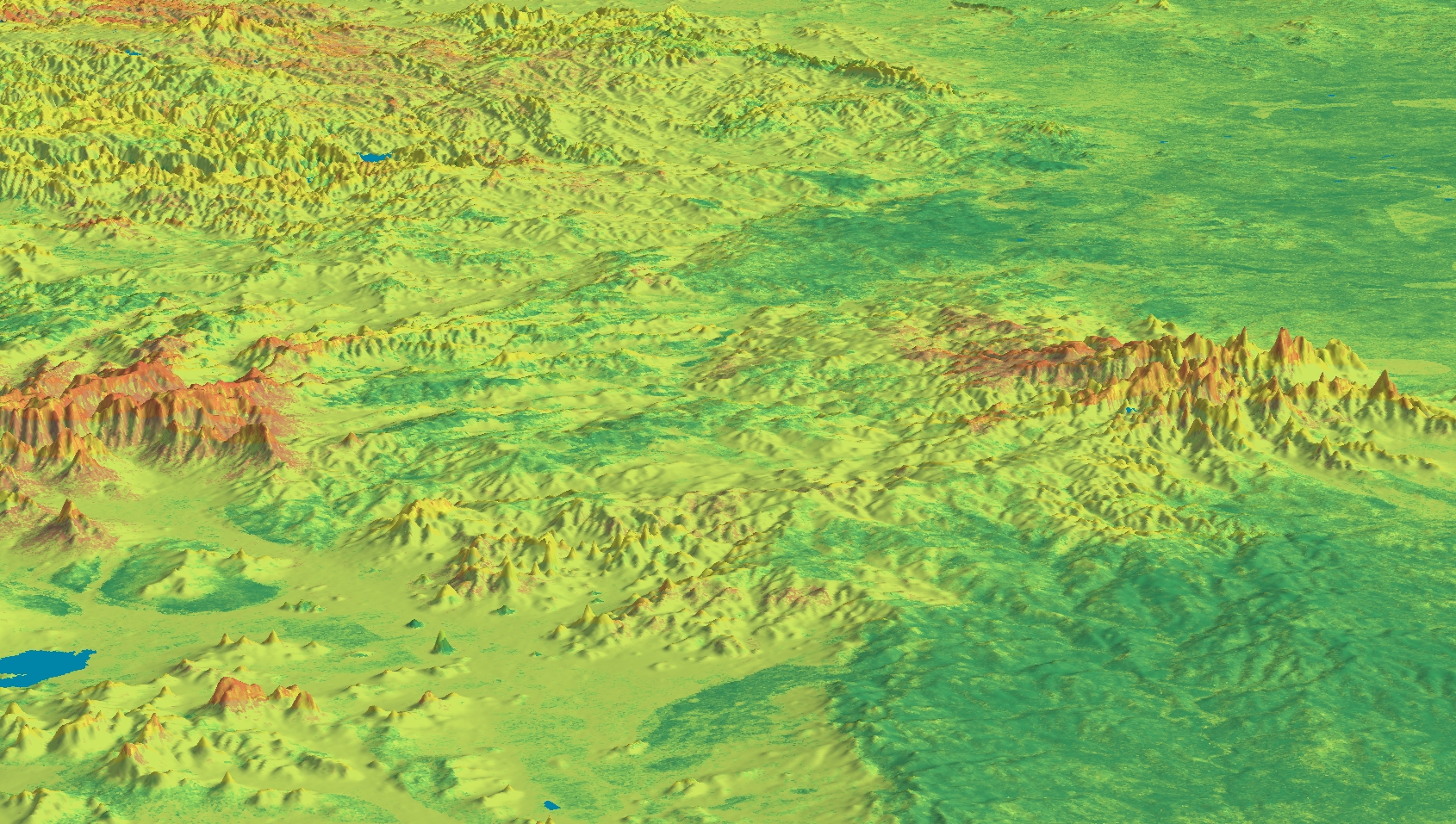
[Camera pans over image of Australia, zooms in to reveal individual pixels, one pixel develops into a 3D view of a sector of the grid]
Each pixel represents an area of 90 metres squared, roughly equivalent to a football field, and has six layers of information down to a depth of two metres below the surface.
[Image of football field, sector expands vertically into strata]
Dozens of attributes are included, such as organic carbon, available water capacity, clay, pH, nutrients and landscape features.
[Image changes to show a grid sector with changing labels, three sectors labelled as Zones, computer modelling]
It is now easier to draw comparisons across the landscape because the data are standardised and include estimates of reliability.
[Image changes to show markers representing people interconnecting on grid]
Researchers from different fields can use and share this data meaning their work is more effective and efficient.
[Image changes to show a map of Australia with land and sky behind, text appears: Soil and Landscape Grid of Australia, connections join up all over the map]
The Soil and Landscape Grid is part of an Australian Government research infrastructure network for the future policy and prosperity of this country. It opens the doors for land managers, communities, and governments to answer important questions.
[Image changes to show a coastal scene, a rural community, cows at pasture, a committee meeting, a busy downtown]
How do the soils in our region shape farming and land use choices?
[Image changes to show grid sectors with different labels]
Where is the best terrain for establishing native vegetation and wildlife habitats?
How might the soil impact our current road and infrastructure plans?
What will you ask?
[Camera zooms out on the grid sectors]
This is just the beginning. The first maps are now available online and free.
[Camera zooms out to show map of Australia with text: Soil and Landscape Grid of Australia on laptop screen]
All that is missing… is you, your questions, and your ideas.
How will you use the Soil and Landscape Grid of Australia?
[Image changes to show a hand with finger outstretched to laptop keyboard]
Discover more at the Soil and Landscape Grid of Australia website.
[Image changes to show sponsor logos and text appears: Soil and Landscape Grid of Australia www.csiro.au/soil-and-lands]
[Music plays]
The entire country is now represented as a digital grid with two billion ‘pixels’ that are about 90 by 90 metres, down to a depth of two metres below the surface.
The Soil and Landscape Grid of Australia, launched today at the National Soil Science Conference in Melbourne, is the result of a partnership between CSIRO, the University of Sydney, several federal, state and territory government agencies and the Terrestrial Ecosystem Research Network (TERN).
The Grid draws information from the partner agency databases weaving together both historical and current data generated from sampling, laboratory sensing, modelling and remote sensing.
The Grid also includes estimates of reliability and is designed to integrate new data in the future – even data generated by technology that has not yet been invented.
Soil and landscape attributes such as soil water, nutrients and clay, affect the sustainability of Australia’s natural resources and the profitability of sectors such as agriculture, mining and infrastructure.
CSIRO Research Director Mike Grundy said the Grid had already woven together hundreds of millions of dollars’ worth of past soil and landscape science into a new ‘digital tapestry’.
"The research community has known we need better ways to make this diverse information available; new science and technology has let us make the most of the rich data we have," Mr Grundy said.
"From exploring new land use options, to making the most of water, to finding habitats for endangered native species, this technology has applications we are only just beginning to imagine."
The Grid will be beneficial to a wide range of applications and users including urban and regional planners, land managers, farming groups, scientists and engineers.
Alexandra Gartmann, CEO at Foundation for Rural & Regional Renewal and former CEO of Birchip Cropping Group, has worked with rural industries for almost two decades. Ms Gartmann said she was excited by the new technology.
"Knowledge is power, and our agricultural industries have a very narrow margin for error these days, so the more knowledge to reduce poor decisions, the better," Ms Gartmann said.
"Agribusiness will benefit from this technology, both at the farm scale — with data to inform production models and risk management decisions — and industry scale, as it draws together many years of past research and knowledge for future investment decisions.
"The Soil and Landscape Grid is a huge leap forward. With its national datasets and consistent and comparable data, it has huge potential for regional development, informing planning and decision-making."
Images
Audio
Background information
Partners
Project partners: CSIRO; University of Sydney; Geoscience Australia; Western Australia Department of Agriculture and Food; Tasmania Department of Primary Industries, Parks, Water and Environment; South Australia Department of Environment, Water and Natural Resources; Queensland Department of Science, Information Technology, Innovation and the Arts; Northern Territory Department of Land Resource Management; Victoria Department of Environment and Primary Industries; New South Wales Office of Environment and Heritage; The Australian Collaborative Land Evaluation Program.
Funding
Significant funding for the project was provided by Terrestrial Ecosystem Research Network supported through the Australian Government’s National Collaborative Research Infrastructure Strategy (NCRIS).