Ecosystem accounts bring together environmental, social, cultural and economic information to improve our understanding of our environmental assets, and their contributions to our economy and wellbeing. It also helps us understand the impact that our economy has on our environmental assets.
 In 2018, Commonwealth, state and territory governments agreed to apply the United Nation's System of Environmental-Economic Accounting (SEEA) across Australia to account for environmental assets such as land, oceans and ecosystems.
To test how ecosystem accounting might be implemented, the then Australian Department of Agriculture, Water and the Environment led a case study in the Gunbower-Koondrook-Perricoota Forest Icon Site (GKP), in partnership with the Murray-Darling Basin Authority.
CSIRO contributed ecological and biodiversity expertise, while private-sector partners Marsden Jacob Associates, GHD and the IDEEA Group brought economic and environmental-economic accounting expertise.
The GKP experimental ecosystem accounts show changes in:
- the extent and condition of GKP ecosystems
- the ecosystem services provided by GKP ecosystems, such as timber, recreation and carbon sequestration
- biodiversity
- the monetary value of some ecosystem services.
The study provides insights into how future ecosystem accounts could be developed and used for other sites, across the entire Murray-Darling Basin and Australia, to reveal the often-hidden value that ecosystems bring, regionally and nationally.
Our contribution
Our partnership of scientists, economists and accounting experts built on decades of international work to further develop environmental-economic accounting methods that tailor, extend, and bring together existing recognised techniques. These included:
Developing conceptual models of ecosystems

- distinguish between changes in GKP ecosystems that are due to natural variability versus human actions
- reduce the misclassification of ecosystem types by explicitly recognising that ecosystems are dynamic
- communicate and synthesise complex ecological information in diagrams
- develop state and transition models, which can be used to predict the future extent of ecosystem states and the capacity of ecosystems to deliver ecosystem services, under scenarios of climate change or land use.
Download the report
Mapping ecosystems
We developed a systematic method to map the location and extent of ecosystems in GKP. By using the dynamic conceptual models aligned with the Australian Ecosystem Models Framework, we could distinguish changes in ecosystem type from natural variation within an ecosystem type. To assess ecosystem extent, we used ecosystem characteristics sourced from expert knowledge, remotely sensed data, experimental land cover accounts, and regionally produced spatial datasets, maps and models.
This method can be applied for other similar ecosystems across Australia, and extended for other types of ecosystems, including agricultural ecosystems.
Download the report
Assessing ecosystem condition

In addition to reporting on the condition of identified ecosystem assets, this spatially continuous dataset can be used to explore other areas of interest within the GKP, such as socioeconomic statistical areas or areas with different land uses.
The approach has the potential to scale up to the entire Murray-Darling Basin or nationally to report an ecosystem condition account.
Download the report
Assessing biodiversity
Biodiversity was assessed using the Biogeographic modelling Infrastructure for Large-scale Biodiversity Indicators (BILBI) system, which uses best-available biological and environmental data, modelling and high-performance computing to assess biodiversity change at fine spatial resolution across the land surface. A suite of species- and community-level biodiversity assessments was used to develop biodiversity accounts. The biodiversity assessments focussed on changes in the extent of suitable habitat for 10 species and on changes in the overall diversity of waterbirds and vascular plants.
The case study demonstrated an approach for developing an operational national accounting framework for biodiversity.
Download the report
Ecosystem accounts bring together environmental, social, cultural and economic information to improve our understanding of our environmental assets, and their contributions to our economy and wellbeing. It also helps us understand the impact that our economy has on our environmental assets.
In 2018, Commonwealth, state and territory governments agreed to apply the United Nation's System of Environmental-Economic Accounting (SEEA) across Australia to account for environmental assets such as land, oceans and ecosystems.
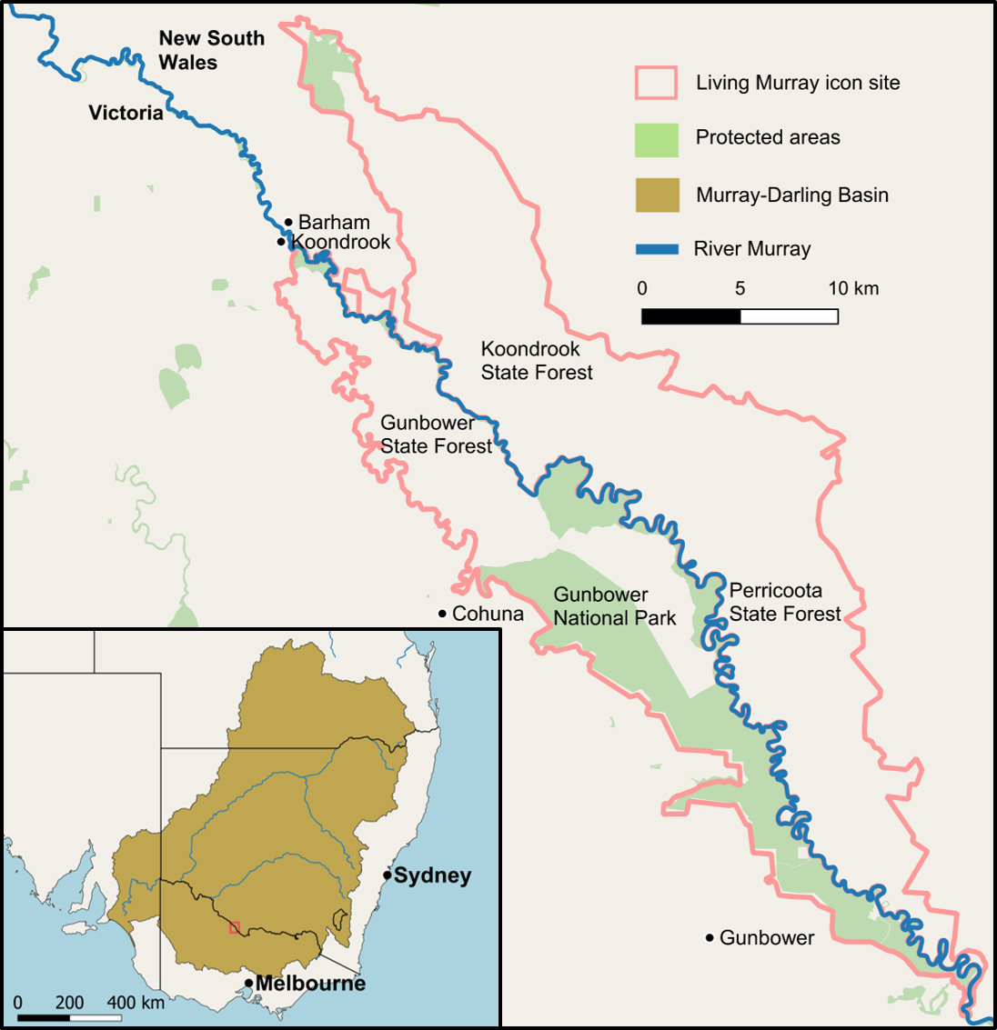
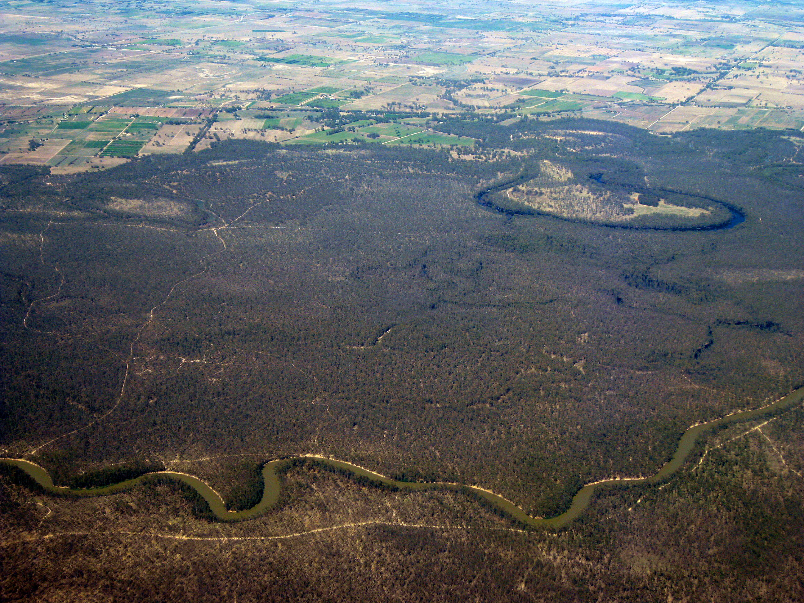
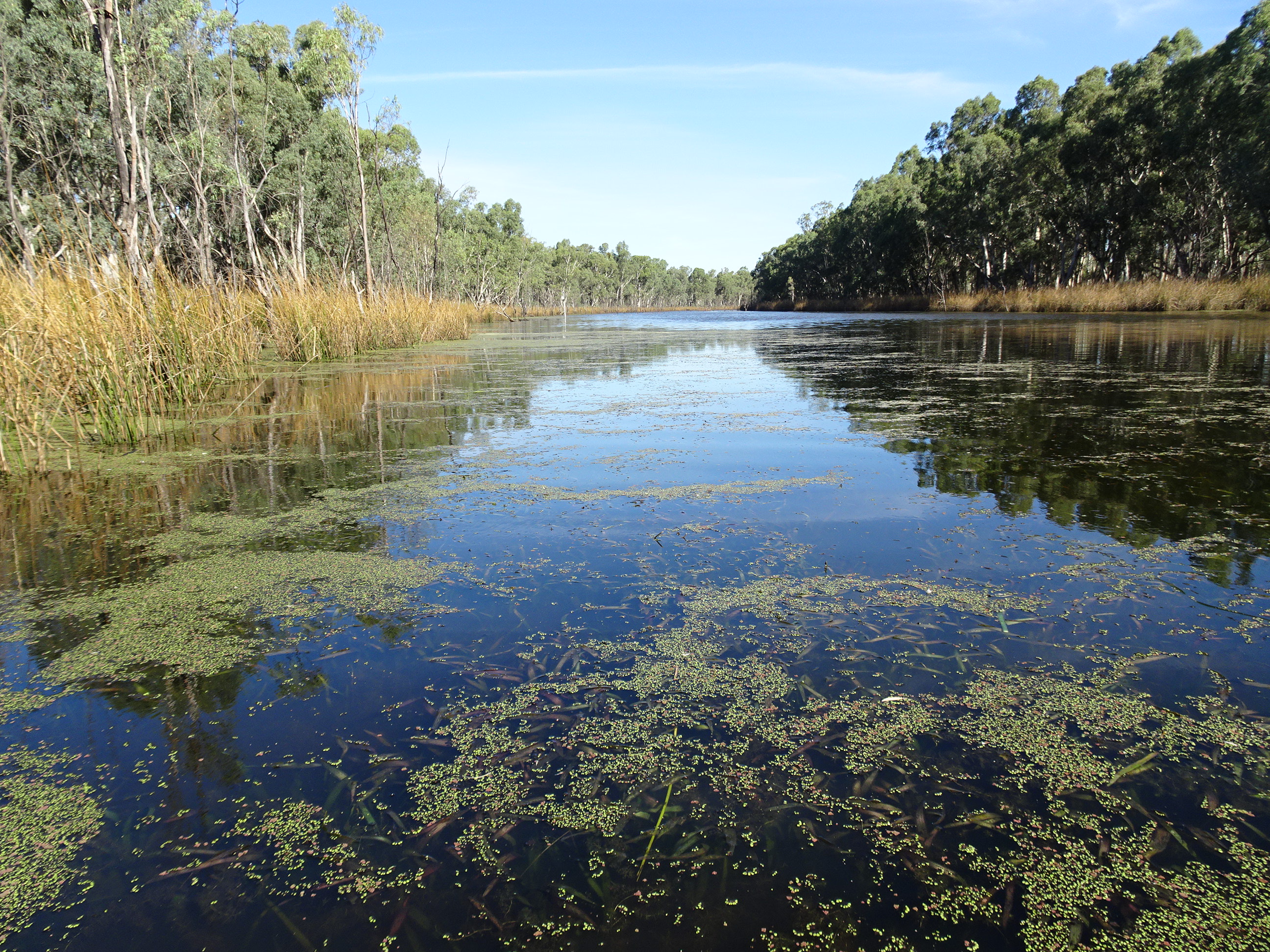
The Gunbower-Koondrook-Perricoota Forest Icon Site spans the river north-west of Echuca, taking in state forest-managed land in NSW, and both national park and state forest in Victoria. GKP is a mosaic of ecosystems: different woodlands, including extensive stands of river red gum; freshwater habitat; and a wetland protected under the Ramsar Convention as an internationally significant nesting site for migratory waterbirds.
To test how ecosystem accounting might be implemented, the then Australian Department of Agriculture, Water and the Environment led a case study in the Gunbower-Koondrook-Perricoota Forest Icon Site (GKP), in partnership with the Murray-Darling Basin Authority.
CSIRO contributed ecological and biodiversity expertise, while private-sector partners Marsden Jacob Associates, GHD and the IDEEA Group brought economic and environmental-economic accounting expertise.
The GKP experimental ecosystem accounts show changes in:
- the extent and condition of GKP ecosystems
- the ecosystem services provided by GKP ecosystems, such as timber, recreation and carbon sequestration
- biodiversity
- the monetary value of some ecosystem services.
The study provides insights into how future ecosystem accounts could be developed and used for other sites, across the entire Murray-Darling Basin and Australia, to reveal the often-hidden value that ecosystems bring, regionally and nationally.
Our contribution
Our partnership of scientists, economists and accounting experts built on decades of international work to further develop environmental-economic accounting methods that tailor, extend, and bring together existing recognised techniques. These included:
Developing conceptual models of ecosystems
CSIRO developed new methods to produce information for environmental-economic accounting using the Australian Ecosystem Models Framework, which captures the only nationally-comprehensive set of conceptual models of ecosystem dynamics for Australia. This approach can:
- distinguish between changes in GKP ecosystems that are due to natural variability versus human actions
- reduce the misclassification of ecosystem types by explicitly recognising that ecosystems are dynamic
- communicate and synthesise complex ecological information in diagrams
- develop state and transition models, which can be used to predict the future extent of ecosystem states and the capacity of ecosystems to deliver ecosystem services, under scenarios of climate change or land use.
Download the report
Mapping ecosystems
We developed a systematic method to map the location and extent of ecosystems in GKP. By using the dynamic conceptual models aligned with the Australian Ecosystem Models Framework, we could distinguish changes in ecosystem type from natural variation within an ecosystem type. To assess ecosystem extent, we used ecosystem characteristics sourced from expert knowledge, remotely sensed data, experimental land cover accounts, and regionally produced spatial datasets, maps and models.
This method can be applied for other similar ecosystems across Australia, and extended for other types of ecosystems, including agricultural ecosystems.
Download the report
Assessing ecosystem condition
The Habitat Condition Assessment System (HCAS) provides Australia with its first consistent, repeatable, and cost-efficient assessment of habitat condition for biodiversity. The HCAS dataset was combined with expert knowledge of ecosystem integrity to derive an index of ecosystem condition for GKP, ranging from 0.0 (lowest integrity) to 1.0 (highest integrity).
In addition to reporting on the condition of identified ecosystem assets, this spatially continuous dataset can be used to explore other areas of interest within the GKP, such as socioeconomic statistical areas or areas with different land uses.
The approach has the potential to scale up to the entire Murray-Darling Basin or nationally to report an ecosystem condition account.
Download the report
Assessing biodiversity
Biodiversity was assessed using the Biogeographic modelling Infrastructure for Large-scale Biodiversity Indicators (BILBI) system, which uses best-available biological and environmental data, modelling and high-performance computing to assess biodiversity change at fine spatial resolution across the land surface. A suite of species- and community-level biodiversity assessments was used to develop biodiversity accounts. The biodiversity assessments focussed on changes in the extent of suitable habitat for 10 species and on changes in the overall diversity of waterbirds and vascular plants.
The case study demonstrated an approach for developing an operational national accounting framework for biodiversity.
