What they're used for
Scientists use data collected by moorings to measure ocean changes over time, and learn more about important ocean currents like the East Australian Current. Their main advantage is that they can collect data over a long period, which helps provide an understanding of long-term changes. This is something that it would be impossible for a research vessel to do, as it cannot stay in one location to collect continuous data for the same time periods.
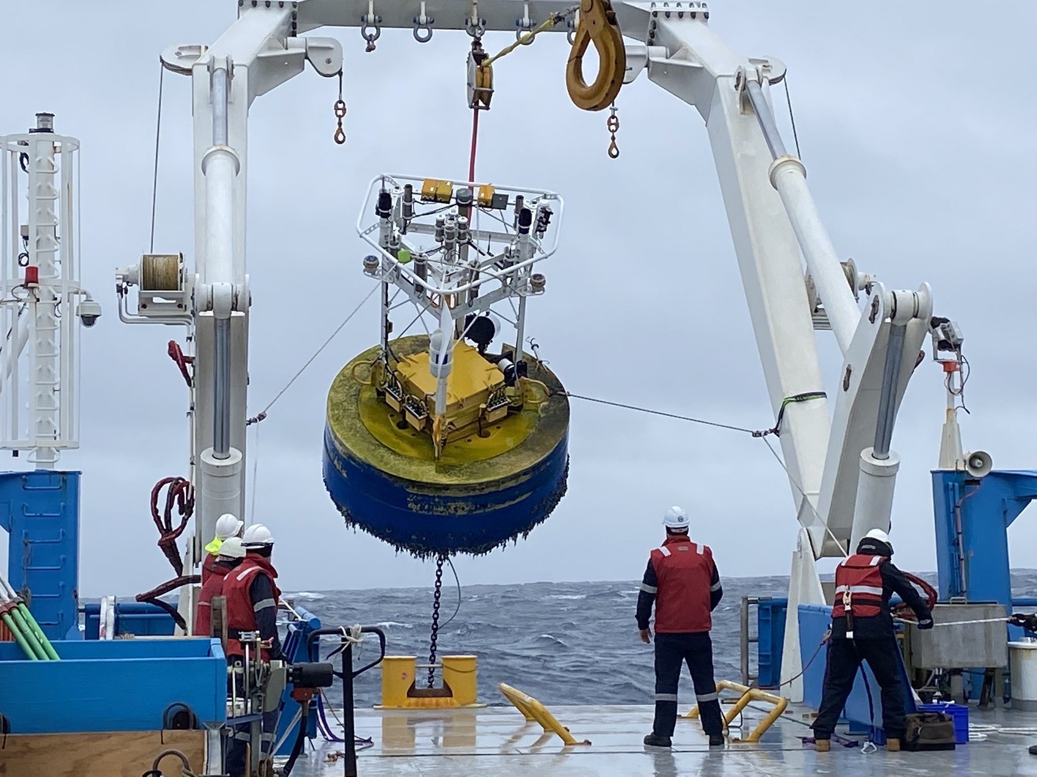
Moorings differ depending on their purpose. Some have a buoy at the top which enables data to be transmitted by a satellite back to shore. Others can be as deep as a kilometre below the surface. For the latter type of moorings, the data and samples are collected when the mooring is retrieved.
Sub-surface moorings measure things like temperature and conductivity at the same depth, across an ocean current. Scientists compare the data from each mooring, to determine changes in the current.
How they work
Mooring lines are deployed with the anchor last, using a parachute to create a gentle descent. The anchor used is commonly a set of train wheels.
When deploying the mooring, the floats and instruments are often laid out behind the vessel as it slowly steams forwards. The anchor is the last item to be lowered off the back deck.
During recovery, a signal is sent from the vessel to special acoustic releases that detach from the anchor and allow the whole mooring to float to the surface.
The top of a sub-surface mooring is typically 20 m below the surface to remove any impact from ocean waves and potential for collision with vessels.
Considerations
Moorings are not a part of RV Investigator’s equipment but their deployment and retrieval for various programs and partnerships is supported by the Marine National Facility. In the support of some programs, the vessel will return to the same location over a series of years to service moorings that remains in place to collect long time-series data.
What they're used for
Scientists use data collected by moorings to measure ocean changes over time, and learn more about important ocean currents like the East Australian Current. Their main advantage is that they can collect data over a long period, which helps provide an understanding of long-term changes. This is something that it would be impossible for a research vessel to do, as it cannot stay in one location to collect continuous data for the same time periods.
Moorings differ depending on their purpose. Some have a buoy at the top which enables data to be transmitted by a satellite back to shore. Others can be as deep as a kilometre below the surface. For the latter type of moorings, the data and samples are collected when the mooring is retrieved.
Sub-surface moorings measure things like temperature and conductivity at the same depth, across an ocean current. Scientists compare the data from each mooring, to determine changes in the current.
How they work
Mooring lines are deployed with the anchor last, using a parachute to create a gentle descent. The anchor used is commonly a set of train wheels.
When deploying the mooring, the floats and instruments are often laid out behind the vessel as it slowly steams forwards. The anchor is the last item to be lowered off the back deck.
During recovery, a signal is sent from the vessel to special acoustic releases that detach from the anchor and allow the whole mooring to float to the surface.
The top of a sub-surface mooring is typically 20 m below the surface to remove any impact from ocean waves and potential for collision with vessels.
Considerations
Moorings are not a part of RV Investigator’s equipment but their deployment and retrieval for various programs and partnerships is supported by the Marine National Facility. In the support of some programs, the vessel will return to the same location over a series of years to service moorings that remains in place to collect long time-series data.
Related to this page
A multiyear partnership between the Integrated Marine Observing System (IMOS) and the MNF is delivering critical time-series ocean data from the Southern Ocean.